
Four Parks-Paces Mill-West Palisades-Cochran Shoals-Johnson Ferry
A cycling route starting in Vinings, Georgia, United States.
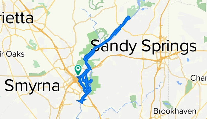
Overview
About this route
This is a nice route, some are path bikes (not presently 12 Oct depicted on google.maps). Some are hike trails. I use my hybrid bike. I think for race bikes is not appropriate unless you walk your bike.
The Columns Dr SE is particularly scenic as you can see very rich house with huge yards. A kind of palaces.
You can think about it as a scenic drive. I like this route very much.
You can visit a few places in
<span class="indent">Chattahoochee River National Recreation Area Map: <br /></span>
-
Paces Mill
-
West Palisades
-
Cochran Shoals
-
Johnson Ferry
- -:--
- Duration
- 32.4 km
- Distance
- 303 m
- Ascent
- 304 m
- Descent
- ---
- Avg. speed
- ---
- Max. altitude
Continue with Bikemap
Use, edit, or download this cycling route
You would like to ride Four Parks-Paces Mill-West Palisades-Cochran Shoals-Johnson Ferry or customize it for your own trip? Here is what you can do with this Bikemap route:
Free features
- Save this route as favorite or in collections
- Copy & plan your own version of this route
- Sync your route with Garmin or Wahoo
Premium features
Free trial for 3 days, or one-time payment. More about Bikemap Premium.
- Navigate this route on iOS & Android
- Export a GPX / KML file of this route
- Create your custom printout (try it for free)
- Download this route for offline navigation
Discover more Premium features.
Get Bikemap PremiumFrom our community
Other popular routes starting in Vinings
 BTB Day1
- Distance
- 128.5 km
- Ascent
- 598 m
- Descent
- 385 m
- Location
- Vinings, Georgia, United States
 chat feb 10
- Distance
- 14.4 km
- Ascent
- 144 m
- Descent
- 158 m
- Location
- Vinings, Georgia, United States
 Work to Windsor
- Distance
- 12 km
- Ascent
- 187 m
- Descent
- 139 m
- Location
- Vinings, Georgia, United States
 Four Parks-Paces Mill-West Palisades-Cochran Shoals-Johnson Ferry
- Distance
- 32.4 km
- Ascent
- 303 m
- Descent
- 304 m
- Location
- Vinings, Georgia, United States
 ATL2STL4
- Distance
- 1,137.1 km
- Ascent
- 1,521 m
- Descent
- 1,652 m
- Location
- Vinings, Georgia, United States
 Access to Silver Comet Trail
- Distance
- 14.8 km
- Ascent
- 287 m
- Descent
- 262 m
- Location
- Vinings, Georgia, United States
 Brasstown bald alternative No. 2
- Distance
- 391.3 km
- Ascent
- 1,712 m
- Descent
- 1,700 m
- Location
- Vinings, Georgia, United States
 hill route
- Distance
- 22.2 km
- Ascent
- 365 m
- Descent
- 365 m
- Location
- Vinings, Georgia, United States
Open it in the app