

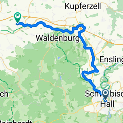
Sulzbach-Vellberg-Geislingen-Hessental
A cycling route starting in Schwäbisch Hall, Baden-Wurttemberg, Germany.
Overview
About this route
- -:--
- Duration
- 46.5 km
- Distance
- 274 m
- Ascent
- 274 m
- Descent
- ---
- Avg. speed
- ---
- Max. altitude
Route quality
Waytypes & surfaces along the route
Waytypes
Track
17.2 km
(37 %)
Road
12.1 km
(26 %)
Surfaces
Paved
29.8 km
(64 %)
Unpaved
1.4 km
(3 %)
Asphalt
25.1 km
(54 %)
Paved (undefined)
4.2 km
(9 %)
Continue with Bikemap
Use, edit, or download this cycling route
You would like to ride Sulzbach-Vellberg-Geislingen-Hessental or customize it for your own trip? Here is what you can do with this Bikemap route:
Free features
- Save this route as favorite or in collections
- Copy & plan your own version of this route
- Sync your route with Garmin or Wahoo
Premium features
Free trial for 3 days, or one-time payment. More about Bikemap Premium.
- Navigate this route on iOS & Android
- Export a GPX / KML file of this route
- Create your custom printout (try it for free)
- Download this route for offline navigation
Discover more Premium features.
Get Bikemap PremiumFrom our community
Other popular routes starting in Schwäbisch Hall
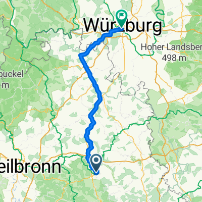
 Schwäbisch Hall- Heilbronn
- Distance
- 52.8 km
- Ascent
- 288 m
- Descent
- 497 m
- Location
- Schwäbisch Hall, Baden-Wurttemberg, Germany
 Wunstorf - Schwäbisch Hall
- Distance
- 636.8 km
- Ascent
- 955 m
- Descent
- 1,284 m
- Location
- Schwäbisch Hall, Baden-Wurttemberg, Germany
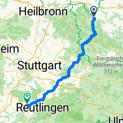
 Lemberg und 2 Seen
- Distance
- 39.1 km
- Ascent
- 484 m
- Descent
- 484 m
- Location
- Schwäbisch Hall, Baden-Wurttemberg, Germany
 Haller 2-Fluesse-Tour
- Distance
- 36.8 km
- Ascent
- 328 m
- Descent
- 328 m
- Location
- Schwäbisch Hall, Baden-Wurttemberg, Germany
 vom Main nach Bad Mergentheim
- Distance
- 111.5 km
- Ascent
- 1,584 m
- Descent
- 1,770 m
- Location
- Schwäbisch Hall, Baden-Wurttemberg, Germany
 Schwäbisch Hall-Rothenburg
- Distance
- 58.7 km
- Ascent
- 504 m
- Descent
- 456 m
- Location
- Schwäbisch Hall, Baden-Wurttemberg, Germany
 Route nach Tübingen
- Distance
- 118.3 km
- Ascent
- 1,592 m
- Descent
- 1,589 m
- Location
- Schwäbisch Hall, Baden-Wurttemberg, Germany
 Von Schwäbisch Hall bis Neuenstein
- Distance
- 28.1 km
- Ascent
- 297 m
- Descent
- 317 m
- Location
- Schwäbisch Hall, Baden-Wurttemberg, Germany
Open it in the app