

Rist Loop from Edora
A cycling route starting in Fort Collins, Colorado, United States.
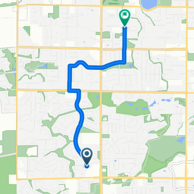
Overview
About this route
Loop up Rist Canyon and down Buckhorn Canyon. Load up with water/food at Vern's in LaPort. There isn't anything until you get to the Masonville store and it may or may not be open.
14 mile climb. Steep part at the top. There are a couple of cattle guards and short uphill sections on the descent. Watch for sand in the corners in the spring. .
- -:--
- Duration
- 85 km
- Distance
- 1,071 m
- Ascent
- 1,071 m
- Descent
- ---
- Avg. speed
- ---
- Max. altitude

Route quality
Waytypes & surfaces along the route
Waytypes
Road
20.4 km
(24 %)
Quiet road
9.4 km
(11 %)
Surfaces
Paved
74.8 km
(88 %)
Asphalt
39.1 km
(46 %)
Paved (undefined)
34 km
(40 %)
Continue with Bikemap
Use, edit, or download this cycling route
You would like to ride Rist Loop from Edora or customize it for your own trip? Here is what you can do with this Bikemap route:
Free features
- Save this route as favorite or in collections
- Copy & plan your own version of this route
- Split it into stages to create a multi-day tour
- Sync your route with Garmin or Wahoo
Premium features
Free trial for 3 days, or one-time payment. More about Bikemap Premium.
- Navigate this route on iOS & Android
- Export a GPX / KML file of this route
- Create your custom printout (try it for free)
- Download this route for offline navigation
Discover more Premium features.
Get Bikemap PremiumFrom our community
Other popular routes starting in Fort Collins
 Safeway to Polaris
- Distance
- 4.4 km
- Ascent
- 3 m
- Descent
- 11 m
- Location
- Fort Collins, Colorado, United States
 Fort Collins Colorado to Loveland Colorado
- Distance
- 55.8 km
- Ascent
- 1,295 m
- Descent
- 1,175 m
- Location
- Fort Collins, Colorado, United States
 Tour Route
- Distance
- 9.7 km
- Ascent
- 24 m
- Descent
- 24 m
- Location
- Fort Collins, Colorado, United States
 Lengthy ride through Fort Collins
- Distance
- 51.2 km
- Ascent
- 356 m
- Descent
- 357 m
- Location
- Fort Collins, Colorado, United States
 Club Ride
- Distance
- 34 km
- Ascent
- 129 m
- Descent
- 129 m
- Location
- Fort Collins, Colorado, United States
 Horsetooth Jaunt
- Distance
- 28 km
- Ascent
- 362 m
- Descent
- 306 m
- Location
- Fort Collins, Colorado, United States
 Bike to Rocky
- Distance
- 244.6 km
- Ascent
- 2,600 m
- Descent
- 2,599 m
- Location
- Fort Collins, Colorado, United States
 Fort Collins Poudre & Spring Creek Trails #1
- Distance
- 15.7 km
- Ascent
- 28 m
- Descent
- 30 m
- Location
- Fort Collins, Colorado, United States
Open it in the app