

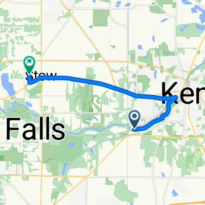
5373 Rootstown Rd, Kent to 3688 Cranberry Hill, Rootstown
A cycling route starting in Kent, Ohio, United States.
Overview
About this route
- 22 min
- Duration
- 8.4 km
- Distance
- 93 m
- Ascent
- 89 m
- Descent
- 23.1 km/h
- Avg. speed
- ---
- Max. altitude
Route quality
Waytypes & surfaces along the route
Waytypes
Quiet road
5.4 km
(65 %)
Busy road
1.4 km
(17 %)
Surfaces
Paved
2.9 km
(34 %)
Asphalt
2.9 km
(34 %)
Undefined
5.5 km
(66 %)
Continue with Bikemap
Use, edit, or download this cycling route
You would like to ride 5373 Rootstown Rd, Kent to 3688 Cranberry Hill, Rootstown or customize it for your own trip? Here is what you can do with this Bikemap route:
Free features
- Save this route as favorite or in collections
- Copy & plan your own version of this route
- Sync your route with Garmin or Wahoo
Premium features
Free trial for 3 days, or one-time payment. More about Bikemap Premium.
- Navigate this route on iOS & Android
- Export a GPX / KML file of this route
- Create your custom printout (try it for free)
- Download this route for offline navigation
Discover more Premium features.
Get Bikemap PremiumFrom our community
Other popular routes starting in Kent
 1324 Middlebury Rd, Stow to 1324 Middlebury Rd, Stow
- Distance
- 33.6 km
- Ascent
- 160 m
- Descent
- 153 m
- Location
- Kent, Ohio, United States
 1700 SR-43, Kent to 1239 Congress Lake Rd, Mogadore
- Distance
- 17.4 km
- Ascent
- 133 m
- Descent
- 113 m
- Location
- Kent, Ohio, United States
 Middlebury Rd, Kent to Adaline Dr, Stow
- Distance
- 10.6 km
- Ascent
- 76 m
- Descent
- 50 m
- Location
- Kent, Ohio, United States
 Recovered Route
- Distance
- 29.1 km
- Ascent
- 174 m
- Descent
- 186 m
- Location
- Kent, Ohio, United States
 115 Lake St, Kent to 115 Lake St, Kent
- Distance
- 23.3 km
- Ascent
- 131 m
- Descent
- 135 m
- Location
- Kent, Ohio, United States
 1005 E Main St, Kent to Boston Heights
- Distance
- 21.2 km
- Ascent
- 68 m
- Descent
- 101 m
- Location
- Kent, Ohio, United States
 Snail-like route in Stow
- Distance
- 10.7 km
- Ascent
- 98 m
- Descent
- 96 m
- Location
- Kent, Ohio, United States
 church to m apartment
- Distance
- 4.6 km
- Ascent
- 52 m
- Descent
- 48 m
- Location
- Kent, Ohio, United States
Open it in the app