
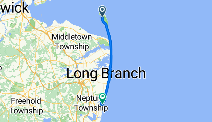
Hartshorne Dr, Atlantic Highlands to 409 Third Ave, Asbury Park
A cycling route starting in Atlantic Highlands, New Jersey, United States of America.
Overview
About this route
- 3 h 6 min
- Duration
- 31.6 km
- Distance
- 80 m
- Ascent
- 76 m
- Descent
- 10.2 km/h
- Avg. speed
- ---
- Max. altitude
Route quality
Waytypes & surfaces along the route
Waytypes
Busy road
13.1 km
(41 %)
Quiet road
6.5 km
(21 %)
Surfaces
Paved
3.8 km
(12 %)
Unpaved
0.2 km
(<1 %)
Asphalt
2.7 km
(9 %)
Paved (undefined)
0.8 km
(2 %)
Continue with Bikemap
Use, edit, or download this cycling route
You would like to ride Hartshorne Dr, Atlantic Highlands to 409 Third Ave, Asbury Park or customize it for your own trip? Here is what you can do with this Bikemap route:
Free features
- Save this route as favorite or in collections
- Copy & plan your own version of this route
- Sync your route with Garmin or Wahoo
Premium features
Free trial for 3 days, or one-time payment. More about Bikemap Premium.
- Navigate this route on iOS & Android
- Export a GPX / KML file of this route
- Create your custom printout (try it for free)
- Download this route for offline navigation
Discover more Premium features.
Get Bikemap PremiumFrom our community
Other popular routes starting in Atlantic Highlands
 Hartshorne Dr, Atlantic Highlands to 409 Third Ave, Asbury Park
- Distance
- 31.6 km
- Ascent
- 80 m
- Descent
- 76 m
- Location
- Atlantic Highlands, New Jersey, United States of America
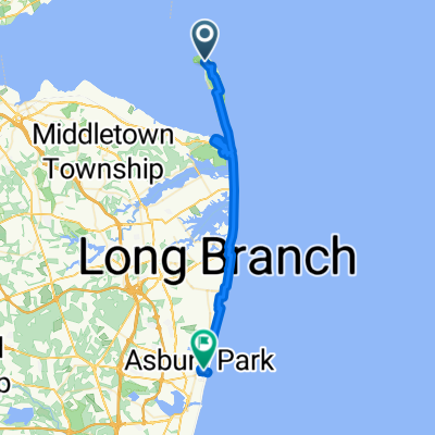
 Harbor View Dr, Atlantic Highlands to Broadway, Matawan
- Distance
- 18.7 km
- Ascent
- 53 m
- Descent
- 43 m
- Location
- Atlantic Highlands, New Jersey, United States of America
 1 Simon Lake Dr, Atlantic Highlands to 1 Simon Lake Dr, Atlantic Highlands
- Distance
- 38.2 km
- Ascent
- 86 m
- Descent
- 84 m
- Location
- Atlantic Highlands, New Jersey, United States of America
 100–113 Ambrose Rd, Atlantic Highlands to 27 Front Cir, Ocean Grove
- Distance
- 42.9 km
- Ascent
- 144 m
- Descent
- 142 m
- Location
- Atlantic Highlands, New Jersey, United States of America
 Recovered Route
- Distance
- 16 km
- Ascent
- 0 m
- Descent
- 10 m
- Location
- Atlantic Highlands, New Jersey, United States of America
 100 First Ave, Atlantic Highlands to 4277–4283 Woodland Ave, Philadelphia
- Distance
- 136 km
- Ascent
- 187 m
- Descent
- 180 m
- Location
- Atlantic Highlands, New Jersey, United States of America
 Atlantic Highlands to Long Branch
- Distance
- 16.9 km
- Ascent
- 88 m
- Descent
- 80 m
- Location
- Atlantic Highlands, New Jersey, United States of America
 Sandy Hook
- Distance
- 14.5 km
- Ascent
- 50 m
- Descent
- 52 m
- Location
- Atlantic Highlands, New Jersey, United States of America
Open it in the app