- 29.4 km
- 654 m
- 564 m
- Bystrzyca Kłodzka, Lower Silesian Voivodeship, Poland
de la Paix 2008 st14
A cycling route starting in Bystrzyca Kłodzka, Lower Silesian Voivodeship, Poland.
Overview
About this route
Bystrzyca Kłodzka - Pradziad Puchaczówka (2), Płoszczyna (3), Slegov (4), Rejviz (2), Opavice (4), Karlova Studanka (3), Nova Ves (4), Skritek (3), Dlouhe Strane (HC), Cervenohorske (3), Videlskie (3), Karlovu (4), Pradziad (1).
- -:--
- Duration
- 249.1 km
- Distance
- 4,302 m
- Ascent
- 3,176 m
- Descent
- ---
- Avg. speed
- ---
- Max. altitude
created this 5 years ago
Route quality
Waytypes & surfaces along the route
Waytypes
Road
52.3 km
21 %
Track
29.9 km
12 %
Surfaces
Paved
201.8 km
(81 %)
Unpaved
10 km
(4 %)
Asphalt
199.3 km
80 %
Unpaved (undefined)
5 km
2 %
Continue with Bikemap
Use, edit, or download this cycling route
You would like to ride de la Paix 2008 st14 or customize it for your own trip? Here is what you can do with this Bikemap route:
Free features
- Save this route as favorite or in collections
- Copy & plan your own version of this route
- Split it into stages to create a multi-day tour
- Sync your route with Garmin or Wahoo
Premium features
Free trial for 3 days, or one-time payment. More about Bikemap Premium.
- Navigate this route on iOS & Android
- Export a GPX / KML file of this route
- Create your custom printout (try it for free)
- Download this route for offline navigation
Discover more Premium features.
Get Bikemap PremiumFrom our community
Other popular routes starting in Bystrzyca Kłodzka
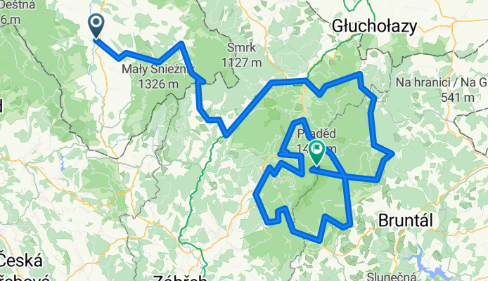
- Od Gmina Bystrzyca Kłodzka do Gmina Stronie Śląskie
- Orlické Záhořà - den tÅ™etÃ
- 41.2 km
- 550 m
- 550 m
- Bystrzyca Kłodzka, Lower Silesian Voivodeship, Poland
- Turek - Rzym 2017
- 1,620 km
- 2,378 m
- 2,681 m
- Bystrzyca Kłodzka, Lower Silesian Voivodeship, Poland
- Bystrzyca Kłodzka - Rychnov nad Kněžnou
- 67.3 km
- 340 m
- 370 m
- Bystrzyca Kłodzka, Lower Silesian Voivodeship, Poland
- Gorzanów – OW Na Koziej Hali
- 54.4 km
- 1,760 m
- 1,357 m
- Bystrzyca Kłodzka, Lower Silesian Voivodeship, Poland
- przez góry
- 36.7 km
- 516 m
- 516 m
- Bystrzyca Kłodzka, Lower Silesian Voivodeship, Poland
- Spalona 2026 D1
- 52 km
- 1,119 m
- 1,112 m
- Bystrzyca Kłodzka, Lower Silesian Voivodeship, Poland
- Górska pętla
- 36.4 km
- 664 m
- 579 m
- Bystrzyca Kłodzka, Lower Silesian Voivodeship, Poland
Open it in the app


