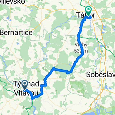
- 69.7 km
- 686 m
- 571 m
- Týn nad Vltavou, Jihočeský kraj, Czechia
Tyn - Klucenice
A cycling route starting in Týn nad Vltavou, Jihočeský kraj, Czechia.
Overview
About this route
Von Tyn geht es zunächst entlang der Hautpstraße nach Albrechtice, hier verlässt man die Hautstraße und durch schattige Waldgebiete führt der Weg nach Pisek. Hier bietet sich eine Rast an. Nach ständigem Auf und Ab auf beiden Seiten der Moldau erreicht man Klucenice, ein idyllisch gelegenes Dorf mit einer gemütlichen Penzion
- -:--
- Duration
- 69.7 km
- Distance
- 686 m
- Ascent
- 571 m
- Descent
- ---
- Avg. speed
- 595 m
- Max. altitude
created this 18 years ago
Route quality
Waytypes & surfaces along the route
Waytypes
Road
19.5 km
28 %
Track
10.5 km
15 %
Surfaces
Paved
26.5 km
(38 %)
Unpaved
2.8 km
(4 %)
Asphalt
26.5 km
38 %
Unpaved (undefined)
1.4 km
2 %
Continue with Bikemap
Use, edit, or download this cycling route
You would like to ride Tyn - Klucenice or customize it for your own trip? Here is what you can do with this Bikemap route:
Free features
- Save this route as favorite or in collections
- Copy & plan your own version of this route
- Sync your route with Garmin or Wahoo
Premium features
Free trial for 3 days, or one-time payment. More about Bikemap Premium.
- Navigate this route on iOS & Android
- Export a GPX / KML file of this route
- Create your custom printout (try it for free)
- Download this route for offline navigation
Discover more Premium features.
Get Bikemap PremiumFrom our community
Other popular routes starting in Týn nad Vltavou
- Tyn - Klucenice
- Týn nad Vltavou - Budweis
- 37.2 km
- 109 m
- 98 m
- Týn nad Vltavou, Jihočeský kraj, Czechia
- Týn nad Vltavou - Krásná Hora nad Vltavou
- 69 km
- 925 m
- 964 m
- Týn nad Vltavou, Jihočeský kraj, Czechia
- Pisek-Kluky
- 65.9 km
- 553 m
- 553 m
- Týn nad Vltavou, Jihočeský kraj, Czechia
- Oparansky okruh
- 60.2 km
- 414 m
- 412 m
- Týn nad Vltavou, Jihočeský kraj, Czechia
- Orlická, Týn nad Vltavou nach 9. května, Tábor
- 45.7 km
- 597 m
- 528 m
- Týn nad Vltavou, Jihočeský kraj, Czechia
- IV. etapa OjČ 2014
- 153.3 km
- 1,034 m
- 921 m
- Týn nad Vltavou, Jihočeský kraj, Czechia
- 2010_10 Týn_Bechyně pěšky
- 17.8 km
- 352 m
- 305 m
- Týn nad Vltavou, Jihočeský kraj, Czechia
Open it in the app


