

XXVI MZC - Miedzynarodowy Zjazd Cyklistow
Bory Postomskie - XXVI MZC
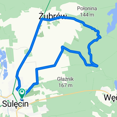
A cycling route starting in Sulęcin, Lesser Poland Voivodeship, Poland.
Overview
About this route
XXVI Międzynarodowy Zjazd Cyklistów w wersji wirtualno-realnej. Trasa na Bory Postomskie przygotowana przez PTTK Ziemia Sulęcińska
- -:--
- Duration
- 19.5 km
- Distance
- 196 m
- Ascent
- 195 m
- Descent
- ---
- Avg. speed
- ---
- Max. altitude

Part of

Route quality
Waytypes & surfaces along the route
Waytypes
Track
12.2 km
(62 %)
Cycleway
2.4 km
(12 %)
Surfaces
Paved
4.5 km
(23 %)
Unpaved
2.2 km
(11 %)
Asphalt
3.3 km
(17 %)
Gravel
2.1 km
(11 %)
Continue with Bikemap
Use, edit, or download this cycling route
You would like to ride Bory Postomskie - XXVI MZC or customize it for your own trip? Here is what you can do with this Bikemap route:
Free features
- Save this route as favorite or in collections
- Copy & plan your own version of this route
- Sync your route with Garmin or Wahoo
Premium features
Free trial for 3 days, or one-time payment. More about Bikemap Premium.
- Navigate this route on iOS & Android
- Export a GPX / KML file of this route
- Create your custom printout (try it for free)
- Download this route for offline navigation
Discover more Premium features.
Get Bikemap PremiumFrom our community
Other popular routes starting in Sulęcin
 Lubniewice
- Distance
- 33.2 km
- Ascent
- 221 m
- Descent
- 220 m
- Location
- Sulęcin, Lesser Poland Voivodeship, Poland
 Żubrów
- Distance
- 42.1 km
- Ascent
- 412 m
- Descent
- 409 m
- Location
- Sulęcin, Lesser Poland Voivodeship, Poland
 Brzeźno 2
- Distance
- 20.9 km
- Ascent
- 181 m
- Descent
- 183 m
- Location
- Sulęcin, Lesser Poland Voivodeship, Poland
 Żubrów 2
- Distance
- 14.8 km
- Ascent
- 126 m
- Descent
- 127 m
- Location
- Sulęcin, Lesser Poland Voivodeship, Poland
 Wyścig szosowy - Sulęcin / Wyścig szosowy - Sulęcin | Strava Ride Segment in Sulęcin, lubuskie, Poland
- Distance
- 26.7 km
- Ascent
- 276 m
- Descent
- 209 m
- Location
- Sulęcin, Lesser Poland Voivodeship, Poland
 Jezioro Ostrowskie - XXVI MZC
- Distance
- 10.7 km
- Ascent
- 86 m
- Descent
- 83 m
- Location
- Sulęcin, Lesser Poland Voivodeship, Poland
 Wąwóz 2
- Distance
- 16 km
- Ascent
- 145 m
- Descent
- 142 m
- Location
- Sulęcin, Lesser Poland Voivodeship, Poland
 Żubrów 3
- Distance
- 20.5 km
- Ascent
- 203 m
- Descent
- 201 m
- Location
- Sulęcin, Lesser Poland Voivodeship, Poland
Open it in the app