

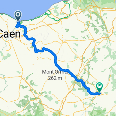
De 98 Avenue du Maréchal Foch, Ouistreham à 46 Boulevard Wattier, Merville-Franceville-Plage
A cycling route starting in Ouistreham, Normandy, France.
Overview
About this route
- 1 h 13 min
- Duration
- 14.5 km
- Distance
- 0 m
- Ascent
- 3 m
- Descent
- 12 km/h
- Avg. speed
- ---
- Max. altitude
Route quality
Waytypes & surfaces along the route
Waytypes
Path
9.2 km
(63 %)
Track
1.3 km
(9 %)
Surfaces
Paved
6.7 km
(46 %)
Unpaved
6.5 km
(45 %)
Asphalt
6.4 km
(44 %)
Loose gravel
4.9 km
(34 %)
Continue with Bikemap
Use, edit, or download this cycling route
You would like to ride De 98 Avenue du Maréchal Foch, Ouistreham à 46 Boulevard Wattier, Merville-Franceville-Plage or customize it for your own trip? Here is what you can do with this Bikemap route:
Free features
- Save this route as favorite or in collections
- Copy & plan your own version of this route
- Sync your route with Garmin or Wahoo
Premium features
Free trial for 3 days, or one-time payment. More about Bikemap Premium.
- Navigate this route on iOS & Android
- Export a GPX / KML file of this route
- Create your custom printout (try it for free)
- Download this route for offline navigation
Discover more Premium features.
Get Bikemap PremiumFrom our community
Other popular routes starting in Ouistreham
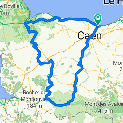 Caen Loop
- Distance
- 381.9 km
- Ascent
- 3,164 m
- Descent
- 3,164 m
- Location
- Ouistreham, Normandy, France
 France 4
- Distance
- 709.5 km
- Ascent
- 4,167 m
- Descent
- 4,164 m
- Location
- Ouistreham, Normandy, France
 Ouistreham - l'Aigle
- Distance
- 122.9 km
- Ascent
- 872 m
- Descent
- 677 m
- Location
- Ouistreham, Normandy, France
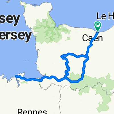
 Ouistreham Circuit
- Distance
- 198.2 km
- Ascent
- 1,225 m
- Descent
- 1,175 m
- Location
- Ouistreham, Normandy, France
 VéloFrancette
- Distance
- 601.3 km
- Ascent
- 509 m
- Descent
- 508 m
- Location
- Ouistreham, Normandy, France
 DAY 1 Route to Hôtel de Normandie
- Distance
- 35.5 km
- Ascent
- 125 m
- Descent
- 119 m
- Location
- Ouistreham, Normandy, France
 Saint Malo Loop
- Distance
- 487.7 km
- Ascent
- 3,424 m
- Descent
- 3,423 m
- Location
- Ouistreham, Normandy, France
 Channel to Med 2018
- Distance
- 1,371.4 km
- Ascent
- 4,308 m
- Descent
- 4,312 m
- Location
- Ouistreham, Normandy, France
Open it in the app