
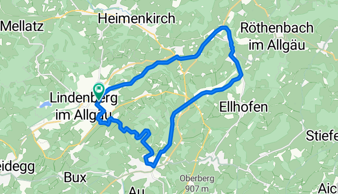
Lindenberg auf den Radweg nach Riedhirsch, Oberhäuser, Weiler und über Schreckenmanklitz wieder nach Ldbg.
A cycling route starting in Weiler-Simmerberg, Bavaria, Germany.
Overview
About this route
- 1 h 59 min
- Duration
- 17.9 km
- Distance
- 179 m
- Ascent
- 186 m
- Descent
- 9 km/h
- Avg. speed
- ---
- Max. altitude

Route photos

Route quality
Waytypes & surfaces along the route
Waytypes
Path
5 km
(28 %)
Cycleway
4.7 km
(26 %)
Surfaces
Paved
14 km
(78 %)
Unpaved
2.1 km
(12 %)
Asphalt
14 km
(78 %)
Pebblestone
1.3 km
(7 %)
Continue with Bikemap
Use, edit, or download this cycling route
You would like to ride Lindenberg auf den Radweg nach Riedhirsch, Oberhäuser, Weiler und über Schreckenmanklitz wieder nach Ldbg. or customize it for your own trip? Here is what you can do with this Bikemap route:
Free features
- Save this route as favorite or in collections
- Copy & plan your own version of this route
- Sync your route with Garmin or Wahoo
Premium features
Free trial for 3 days, or one-time payment. More about Bikemap Premium.
- Navigate this route on iOS & Android
- Export a GPX / KML file of this route
- Create your custom printout (try it for free)
- Download this route for offline navigation
Discover more Premium features.
Get Bikemap PremiumFrom our community
Other popular routes starting in Weiler-Simmerberg
 Westallgäuer Trailrunde 1
- Distance
- 21.3 km
- Ascent
- 414 m
- Descent
- 414 m
- Location
- Weiler-Simmerberg, Bavaria, Germany
 Weiler Hausbachklamm_Wanderung
- Distance
- 14.9 km
- Ascent
- 369 m
- Descent
- 370 m
- Location
- Weiler-Simmerberg, Bavaria, Germany
 Lindenberg-Pfänder
- Distance
- 57.6 km
- Ascent
- 1,065 m
- Descent
- 1,278 m
- Location
- Weiler-Simmerberg, Bavaria, Germany
 Weiler Oberstaufen
- Distance
- 46.2 km
- Ascent
- 683 m
- Descent
- 683 m
- Location
- Weiler-Simmerberg, Bavaria, Germany
 All7: Weiler im Allgäu - Sonthofen; 70,8km 760hm
- Distance
- 70.8 km
- Ascent
- 943 m
- Descent
- 840 m
- Location
- Weiler-Simmerberg, Bavaria, Germany
 Weiler Oberstaufen CLONED FROM ROUTE 62039
- Distance
- 46.2 km
- Ascent
- 683 m
- Descent
- 683 m
- Location
- Weiler-Simmerberg, Bavaria, Germany
 Lindenberg - Oberstdorf
- Distance
- 62.7 km
- Ascent
- 521 m
- Descent
- 458 m
- Location
- Weiler-Simmerberg, Bavaria, Germany
 zum Freibad
- Distance
- 6.2 km
- Ascent
- 39 m
- Descent
- 40 m
- Location
- Weiler-Simmerberg, Bavaria, Germany
Open it in the app