

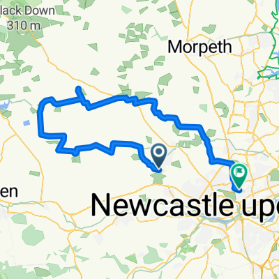
Stamfordham Dog Walk
A cycling route starting in Darras Hall, England, United Kingdom.
Overview
About this route
- -:--
- Duration
- 10.3 km
- Distance
- 43 m
- Ascent
- 39 m
- Descent
- ---
- Avg. speed
- ---
- Max. altitude

Route quality
Waytypes & surfaces along the route
Waytypes
Track
2.3 km
(22 %)
Pedestrian area
2.3 km
(22 %)
Surfaces
Paved
0.7 km
(7 %)
Unpaved
0.2 km
(2 %)
Asphalt
0.7 km
(7 %)
Mud
0.2 km
(2 %)
Undefined
9.4 km
(91 %)
Continue with Bikemap
Use, edit, or download this cycling route
You would like to ride Stamfordham Dog Walk or customize it for your own trip? Here is what you can do with this Bikemap route:
Free features
- Save this route as favorite or in collections
- Copy & plan your own version of this route
- Sync your route with Garmin or Wahoo
Premium features
Free trial for 3 days, or one-time payment. More about Bikemap Premium.
- Navigate this route on iOS & Android
- Export a GPX / KML file of this route
- Create your custom printout (try it for free)
- Download this route for offline navigation
Discover more Premium features.
Get Bikemap PremiumFrom our community
Other popular routes starting in Darras Hall
 Ponteland CP, Newcastle Upon Tyne to 33 Macadam St, Gateshead
- Distance
- 17.9 km
- Ascent
- 174 m
- Descent
- 228 m
- Location
- Darras Hall, England, United Kingdom
 wylam
wylam- Distance
- 11.2 km
- Ascent
- 61 m
- Descent
- 147 m
- Location
- Darras Hall, England, United Kingdom
 Caitystoonride
- Distance
- 70 km
- Ascent
- 448 m
- Descent
- 515 m
- Location
- Darras Hall, England, United Kingdom
 Stamfordham Dog Walk
- Distance
- 10.3 km
- Ascent
- 43 m
- Descent
- 39 m
- Location
- Darras Hall, England, United Kingdom
 10 The Drey, Newcastle Upon Tyne to 5 Fountain Cottages, Hexham
- Distance
- 47.6 km
- Ascent
- 608 m
- Descent
- 573 m
- Location
- Darras Hall, England, United Kingdom
 Recovered Route
- Distance
- 69.3 km
- Ascent
- 701 m
- Descent
- 703 m
- Location
- Darras Hall, England, United Kingdom
 Ponteland CP, Newcastle Upon Tyne to 35 Macadam St, Gateshead
- Distance
- 17.9 km
- Ascent
- 179 m
- Descent
- 225 m
- Location
- Darras Hall, England, United Kingdom
 Cyclone 60
- Distance
- 89.3 km
- Ascent
- 735 m
- Descent
- 735 m
- Location
- Darras Hall, England, United Kingdom
Open it in the app