

Schmidiiis Tour am Tag der Deutschen Einheit 2010
A cycling route starting in Stoßdorf, North Rhine-Westphalia, Germany.
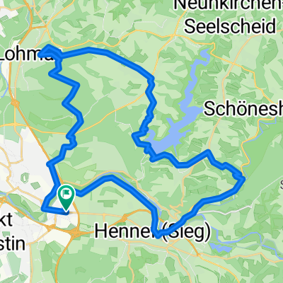
Overview
About this route
Strecke überwiegend auf verkehrsarmen Straßen.
Einfache Orientierung.
Beliebig verkürz-/verlängerbar.
Diverse Einkehr-/Versorgungsmöglichkeiten.
Brauhaus Meigersmühle lohnt einen Stop.
Profil wellig und nur für Trainierte ein Spaß.
Schöne Aussichten.
Start und Ziel variabel.
- -:--
- Duration
- 61.2 km
- Distance
- 562 m
- Ascent
- 562 m
- Descent
- ---
- Avg. speed
- ---
- Avg. speed

Route quality
Waytypes & surfaces along the route
Waytypes
Busy road
22.7 km
(37 %)
Road
11 km
(18 %)
Surfaces
Paved
51.2 km
(84 %)
Unpaved
2.5 km
(4 %)
Asphalt
47.3 km
(77 %)
Paved (undefined)
3.1 km
(5 %)
Continue with Bikemap
Use, edit, or download this cycling route
You would like to ride Schmidiiis Tour am Tag der Deutschen Einheit 2010 or customize it for your own trip? Here is what you can do with this Bikemap route:
Free features
- Save this route as favorite or in collections
- Copy & plan your own version of this route
- Sync your route with Garmin or Wahoo
Premium features
Free trial for 3 days, or one-time payment. More about Bikemap Premium.
- Navigate this route on iOS & Android
- Export a GPX / KML file of this route
- Create your custom printout (try it for free)
- Download this route for offline navigation
Discover more Premium features.
Get Bikemap PremiumFrom our community
Other popular routes starting in Stoßdorf
 Radrunde durch Siegburg
- Distance
- 18.8 km
- Ascent
- 240 m
- Descent
- 240 m
- Location
- Stoßdorf, North Rhine-Westphalia, Germany
 Bröltal-Talsperre-Lohmar-Wald-Runde Ski&Bike
- Distance
- 37.2 km
- Ascent
- 351 m
- Descent
- 351 m
- Location
- Stoßdorf, North Rhine-Westphalia, Germany
 Lohmar_HohChiMinhTrail
- Distance
- 3.8 km
- Ascent
- 4 m
- Descent
- 55 m
- Location
- Stoßdorf, North Rhine-Westphalia, Germany
 Siebengebirgs Runde"Hausstrecke" Bike&Ski
- Distance
- 40.9 km
- Ascent
- 543 m
- Descent
- 543 m
- Location
- Stoßdorf, North Rhine-Westphalia, Germany
 Schnell mal um die Talsperre ;-)
- Distance
- 24.2 km
- Ascent
- 0 m
- Descent
- 0 m
- Location
- Stoßdorf, North Rhine-Westphalia, Germany
 Cafe´Christel - Ho Chi Minh-Pfad - Wahner Heide
- Distance
- 28 km
- Ascent
- 242 m
- Descent
- 242 m
- Location
- Stoßdorf, North Rhine-Westphalia, Germany
 Siegburg-Rheinaue-Westerwald-Runde
- Distance
- 128.3 km
- Ascent
- 1,326 m
- Descent
- 1,254 m
- Location
- Stoßdorf, North Rhine-Westphalia, Germany
 Lohmar-Talsperren Runde 37KM
- Distance
- 37 km
- Ascent
- 515 m
- Descent
- 506 m
- Location
- Stoßdorf, North Rhine-Westphalia, Germany
Open it in the app