

To Radovna over Jesenice
A cycling route starting in Bled, Občina Bled, Slovenia.
Overview
About this route
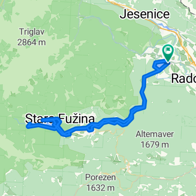
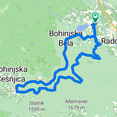
This is a circular route that will take you from Bled over Gorje and Kočna to Jesenice, then to Mojstrana and to Radovna valley. It is approx. km long, with three more difficult climbs. It could be done within three hours.
Krožna pot z Bleda (postaja Union) do Gorij, Kočne, skozi Jesenice do Mojstrane in nato v dolino Radovne ter okoli Blejskega jezera. Pot je srednje težavna s tremi večjimi vzpoini.
- -:--
- Duration
- 51.3 km
- Distance
- 544 m
- Ascent
- 543 m
- Descent
- ---
- Avg. speed
- ---
- Max. altitude

Route quality
Waytypes & surfaces along the route
Waytypes
Road
27.2 km
(53 %)
Quiet road
12.8 km
(25 %)
Surfaces
Paved
44.7 km
(87 %)
Unpaved
2.1 km
(4 %)
Asphalt
44.7 km
(87 %)
Gravel
2.1 km
(4 %)
Undefined
4.6 km
(9 %)
Continue with Bikemap
Use, edit, or download this cycling route
You would like to ride To Radovna over Jesenice or customize it for your own trip? Here is what you can do with this Bikemap route:
Free features
- Save this route as favorite or in collections
- Copy & plan your own version of this route
- Sync your route with Garmin or Wahoo
Premium features
Free trial for 3 days, or one-time payment. More about Bikemap Premium.
- Navigate this route on iOS & Android
- Export a GPX / KML file of this route
- Create your custom printout (try it for free)
- Download this route for offline navigation
Discover more Premium features.
Get Bikemap PremiumFrom our community
Other popular routes starting in Bled
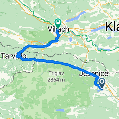 Prešernova cesta, Bled to Bahnhofplatz, Villach
- Distance
- 84.3 km
- Ascent
- 1,506 m
- Descent
- 1,509 m
- Location
- Bled, Občina Bled, Slovenia
 Bled Kupljenik
- Distance
- 21.4 km
- Ascent
- 510 m
- Descent
- 510 m
- Location
- Bled, Občina Bled, Slovenia
 Savska cesta, Bled až Kolodvorska cesta, Bled
- Distance
- 5.3 km
- Ascent
- 96 m
- Descent
- 53 m
- Location
- Bled, Občina Bled, Slovenia
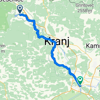
 Biking from Bled to Bohinj
- Distance
- 77.2 km
- Ascent
- 485 m
- Descent
- 487 m
- Location
- Bled, Občina Bled, Slovenia
 Bled - krog
- Distance
- 19.4 km
- Ascent
- 350 m
- Descent
- 350 m
- Location
- Bled, Občina Bled, Slovenia
 Bled - Tarvisio
- Distance
- 63.8 km
- Ascent
- 899 m
- Descent
- 1,102 m
- Location
- Bled, Občina Bled, Slovenia
 Route in Bled
- Distance
- 60 km
- Ascent
- 1,949 m
- Descent
- 1,948 m
- Location
- Bled, Občina Bled, Slovenia
 Radovna
- Distance
- 52.4 km
- Ascent
- 625 m
- Descent
- 628 m
- Location
- Bled, Občina Bled, Slovenia
Open it in the app