


Baulmes, L'Isle, Biere, Cossonay, La Sarraz, Baulmes
- 92.6 km
- 795 m
- 795 m
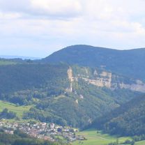
- Sainte-Croix, Canton of Vaud, Switzerland
47° Nord Juratour
A cycling route starting in Sainte-Croix, Canton of Vaud, Switzerland.
Overview
created this 5 years ago
Part of
8 stages
Route quality
Quiet road
51.7 km
(51 %)
Road
19.3 km
(19 %)
Paved
59.8 km
(59 %)
Unpaved
4.1 km
(4 %)
Asphalt
52.7 km
(52 %)
Concrete
4.1 km
(4 %)
Route highlights
Brunnen
Brunnen
Baumgartnes B&B https://bnb.ch/de/bnb/807?gclid=EAIaIQobChMIj9aalMPh6wIVA6p3Ch2XEgbUEAAYASAAEgKaTPD_BwE
Continue with Bikemap
You would like to ride 47° Nord Juratour #5 or customize it for your own trip? Here is what you can do with this Bikemap route:
Free trial for 3 days, or one-time payment. More about Bikemap Premium.
Discover more Premium features.
Get Bikemap PremiumFrom our community
Open it in the app


