
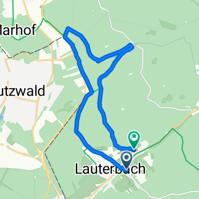
Köhlerstraße 21, Völklingen nach Fischbachstraße 8, Völklingen
- 13.2 km
- 118 m
- 89 m
- Lauterbach, Saarland, Germany
A cycling route starting in Lauterbach, Saarland, Germany.
Overview
mainly low-traffic roads; at the four marked points, a little attention is required due to the poor road surface, but they are still passable on a racing bike.
created this 17 years ago
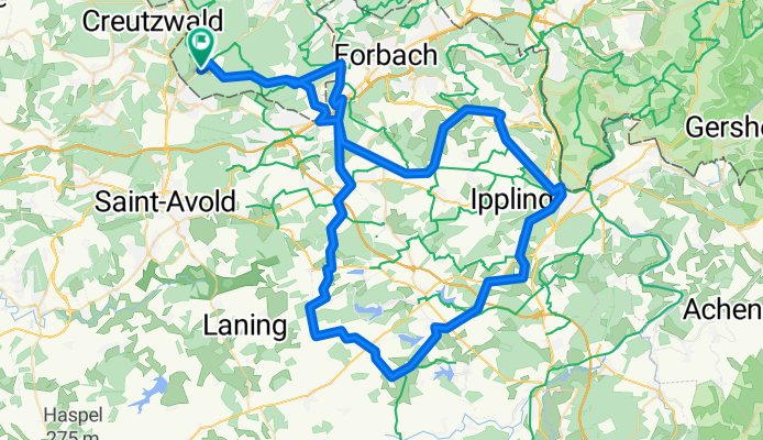
Route quality
Road
51.6 km
56 %
Quiet road
23 km
25 %
Paved
32.2 km
(35 %)
Unpaved
0.9 km
(1 %)
Asphalt
29.5 km
32 %
Paved (undefined)
2.8 km
3 %
Route highlights
schlechte Wegstrecke auf wenigen Metern
schlechte Wegstrecke auf wenigen Metern
schlechte Wegstrecke auf wenigen Metern
schlechte Wegstrecke auf wenigen Metern
Continue with Bikemap
You would like to ride Route1 Lauterbach - Woustviller und zurück or customize it for your own trip? Here is what you can do with this Bikemap route:
Free trial for 3 days, or one-time payment. More about Bikemap Premium.
Discover more Premium features.
Get Bikemap PremiumFrom our community
Open it in the app


