

Lucka-Kammerforst-Stauseemauer Windischleuba-Pahnaer See-Haselbacher See-Lucka
A cycling route starting in Lucka, Thuringia, Germany.
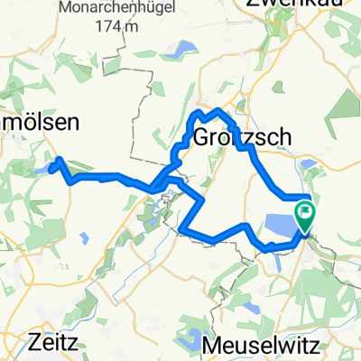
Overview
About this route
Stausee Windischleuba
Pahnaer See mit Campingplatz
- -:--
- Duration
- 38.4 km
- Distance
- 182 m
- Ascent
- 181 m
- Descent
- ---
- Avg. speed
- ---
- Max. altitude

Route quality
Waytypes & surfaces along the route
Waytypes
Quiet road
12.7 km
(33 %)
Track
11.5 km
(30 %)
Surfaces
Paved
20 km
(52 %)
Unpaved
11.5 km
(30 %)
Asphalt
19.2 km
(50 %)
Gravel
8.8 km
(23 %)
Continue with Bikemap
Use, edit, or download this cycling route
You would like to ride Lucka-Kammerforst-Stauseemauer Windischleuba-Pahnaer See-Haselbacher See-Lucka or customize it for your own trip? Here is what you can do with this Bikemap route:
Free features
- Save this route as favorite or in collections
- Copy & plan your own version of this route
- Sync your route with Garmin or Wahoo
Premium features
Free trial for 3 days, or one-time payment. More about Bikemap Premium.
- Navigate this route on iOS & Android
- Export a GPX / KML file of this route
- Create your custom printout (try it for free)
- Download this route for offline navigation
Discover more Premium features.
Get Bikemap PremiumFrom our community
Other popular routes starting in Lucka
 Ab ins Erzgebirge
- Distance
- 82.6 km
- Ascent
- 1,215 m
- Descent
- 886 m
- Location
- Lucka, Thuringia, Germany
 Lucka- Mumsdorf - Meuselwitz - Wintersdorf - 250511 - 31,2km
- Distance
- 31.2 km
- Ascent
- 111 m
- Descent
- 108 m
- Location
- Lucka, Thuringia, Germany
 Lucka - Mondsee
- Distance
- 47.7 km
- Ascent
- 139 m
- Descent
- 141 m
- Location
- Lucka, Thuringia, Germany
 Lucka - Hartsee - Pahnaer See - Lucka
- Distance
- 50.7 km
- Ascent
- 193 m
- Descent
- 193 m
- Location
- Lucka, Thuringia, Germany
 Lucka-Mumsdorf-Meuselwitz-Waldessaum-Lucka
- Distance
- 21.5 km
- Ascent
- 60 m
- Descent
- 60 m
- Location
- Lucka, Thuringia, Germany
 Lucka- Cospudener See
- Distance
- 56.1 km
- Ascent
- 81 m
- Descent
- 82 m
- Location
- Lucka, Thuringia, Germany
 Lucka-Regis-Blumroda-Zedtlitz-Bockwitzer See-Lucka
- Distance
- 50.8 km
- Ascent
- 171 m
- Descent
- 171 m
- Location
- Lucka, Thuringia, Germany
 Rund um den Tagebau Schleenhain
- Distance
- 27.2 km
- Ascent
- 73 m
- Descent
- 73 m
- Location
- Lucka, Thuringia, Germany
Open it in the app