

GT2-8 Maiersreuth-Bad Elster
A cycling route starting in Dolní Žandov, Karlovarský kraj, Czechia.
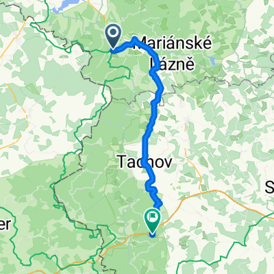
Overview
About this route
Germany Border Tour 14th Day from Maiersreuth to Bad Elster
- -:--
- Duration
- 82.2 km
- Distance
- 1,084 m
- Ascent
- 1,023 m
- Descent
- ---
- Avg. speed
- 675 m
- Max. altitude

Route quality
Waytypes & surfaces along the route
Waytypes
Quiet road
25.5 km
(31 %)
Track
21.4 km
(26 %)
Surfaces
Paved
27.1 km
(33 %)
Unpaved
18.9 km
(23 %)
Asphalt
22.2 km
(27 %)
Gravel
16.4 km
(20 %)
Continue with Bikemap
Use, edit, or download this cycling route
You would like to ride GT2-8 Maiersreuth-Bad Elster or customize it for your own trip? Here is what you can do with this Bikemap route:
Free features
- Save this route as favorite or in collections
- Copy & plan your own version of this route
- Split it into stages to create a multi-day tour
- Sync your route with Garmin or Wahoo
Premium features
Free trial for 3 days, or one-time payment. More about Bikemap Premium.
- Navigate this route on iOS & Android
- Export a GPX / KML file of this route
- Create your custom printout (try it for free)
- Download this route for offline navigation
Discover more Premium features.
Get Bikemap PremiumFrom our community
Other popular routes starting in Dolní Žandov
 Stezka
- Distance
- 21.4 km
- Ascent
- 332 m
- Descent
- 339 m
- Location
- Dolní Žandov, Karlovarský kraj, Czechia
 Horní Žandov - Nebanice
- Distance
- 37.2 km
- Ascent
- 200 m
- Descent
- 200 m
- Location
- Dolní Žandov, Karlovarský kraj, Czechia
 Sibyllenbadrunde
- Distance
- 92.6 km
- Ascent
- 851 m
- Descent
- 851 m
- Location
- Dolní Žandov, Karlovarský kraj, Czechia
 Salajna - Mariánské Lázně - Magistrála Český les - Domažlice
- Distance
- 120.6 km
- Ascent
- 1,110 m
- Descent
- 1,157 m
- Location
- Dolní Žandov, Karlovarský kraj, Czechia
 20140525_132152.gpx
- Distance
- 15.3 km
- Ascent
- 137 m
- Descent
- 205 m
- Location
- Dolní Žandov, Karlovarský kraj, Czechia
 Dolní Žandov - Přimda
- Distance
- 52.3 km
- Ascent
- 652 m
- Descent
- 684 m
- Location
- Dolní Žandov, Karlovarský kraj, Czechia
 Slavkovský les II
- Distance
- 83.2 km
- Ascent
- 1,059 m
- Descent
- 1,074 m
- Location
- Dolní Žandov, Karlovarský kraj, Czechia
 GT2-8 Maiersreuth-Bad Elster
- Distance
- 82.2 km
- Ascent
- 1,084 m
- Descent
- 1,023 m
- Location
- Dolní Žandov, Karlovarský kraj, Czechia
Open it in the app