

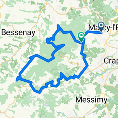
De 42 Chemin des Églantines, Marcy-l'Étoile à 16–180 Chemin des Alouettes, Vaugneray
A cycling route starting in Sainte-Consorce, Auvergne-Rhône-Alpes, France.
Overview
About this route
- 41 min
- Duration
- 9.6 km
- Distance
- 209 m
- Ascent
- 168 m
- Descent
- 14.2 km/h
- Avg. speed
- ---
- Max. altitude
Route quality
Waytypes & surfaces along the route
Waytypes
Quiet road
6.1 km
(64 %)
Road
1.3 km
(14 %)
Surfaces
Paved
5.4 km
(56 %)
Asphalt
5.4 km
(56 %)
Undefined
4.2 km
(44 %)
Continue with Bikemap
Use, edit, or download this cycling route
You would like to ride De 42 Chemin des Églantines, Marcy-l'Étoile à 16–180 Chemin des Alouettes, Vaugneray or customize it for your own trip? Here is what you can do with this Bikemap route:
Free features
- Save this route as favorite or in collections
- Copy & plan your own version of this route
- Sync your route with Garmin or Wahoo
Premium features
Free trial for 3 days, or one-time payment. More about Bikemap Premium.
- Navigate this route on iOS & Android
- Export a GPX / KML file of this route
- Create your custom printout (try it for free)
- Download this route for offline navigation
Discover more Premium features.
Get Bikemap PremiumFrom our community
Other popular routes starting in Sainte-Consorce
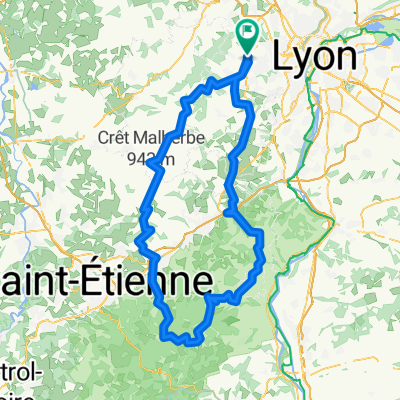
 Monts du Lyonnis
- Distance
- 49 km
- Ascent
- 1,135 m
- Descent
- 1,078 m
- Location
- Sainte-Consorce, Auvergne-Rhône-Alpes, France
 De Chemin de l'Hôpital 71F, Sainte-Consorce à Impasse Rivoire 5, Saint-Genis-Laval
- Distance
- 16.9 km
- Ascent
- 183 m
- Descent
- 314 m
- Location
- Sainte-Consorce, Auvergne-Rhône-Alpes, France
 Lyons Kleiner Bergstern
- Distance
- 41.6 km
- Ascent
- 682 m
- Descent
- 681 m
- Location
- Sainte-Consorce, Auvergne-Rhône-Alpes, France
 Ste Consorce
- Distance
- 13.9 km
- Ascent
- 571 m
- Descent
- 527 m
- Location
- Sainte-Consorce, Auvergne-Rhône-Alpes, France
 marcy 1h vélo - col de la croix du ban
- Distance
- 21.4 km
- Ascent
- 402 m
- Descent
- 402 m
- Location
- Sainte-Consorce, Auvergne-Rhône-Alpes, France
 VTT Monts Lyonnais - Chapel
- Distance
- 21.1 km
- Ascent
- 389 m
- Descent
- 390 m
- Location
- Sainte-Consorce, Auvergne-Rhône-Alpes, France
 Le pilat V2
- Distance
- 156 km
- Ascent
- 2,191 m
- Descent
- 2,197 m
- Location
- Sainte-Consorce, Auvergne-Rhône-Alpes, France
 balade vélo famille
- Distance
- 12.5 km
- Ascent
- 289 m
- Descent
- 283 m
- Location
- Sainte-Consorce, Auvergne-Rhône-Alpes, France
Open it in the app