

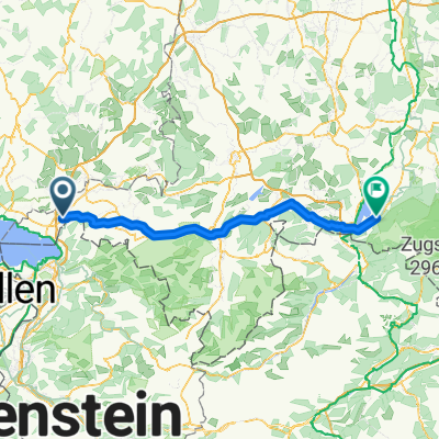
Mollenberg 25, Hergensweiler nach Grasbeurer Straße 3, Uhldingen-Mühlhofen
A cycling route starting in Sigmarszell, Bavaria, Germany.
Overview
About this route
- 2 h 57 min
- Duration
- 50 km
- Distance
- 383 m
- Ascent
- 506 m
- Descent
- 17 km/h
- Avg. speed
- ---
- Max. altitude

Route quality
Waytypes & surfaces along the route
Waytypes
Road
12.4 km
(25 %)
Path
11.5 km
(23 %)
Surfaces
Paved
48 km
(96 %)
Unpaved
0.4 km
(<1 %)
Asphalt
45.3 km
(91 %)
Paving stones
2.2 km
(4 %)
Continue with Bikemap
Use, edit, or download this cycling route
You would like to ride Mollenberg 25, Hergensweiler nach Grasbeurer Straße 3, Uhldingen-Mühlhofen or customize it for your own trip? Here is what you can do with this Bikemap route:
Free features
- Save this route as favorite or in collections
- Copy & plan your own version of this route
- Sync your route with Garmin or Wahoo
Premium features
Free trial for 3 days, or one-time payment. More about Bikemap Premium.
- Navigate this route on iOS & Android
- Export a GPX / KML file of this route
- Create your custom printout (try it for free)
- Download this route for offline navigation
Discover more Premium features.
Get Bikemap PremiumFrom our community
Other popular routes starting in Sigmarszell
 hoenweiler - neuravensbuersee - amtzell - degersee - h.
- Distance
- 52.5 km
- Ascent
- 358 m
- Descent
- 360 m
- Location
- Sigmarszell, Bavaria, Germany
 Von Sigmarszell zum Bannwaldsee
- Distance
- 97.4 km
- Ascent
- 994 m
- Descent
- 712 m
- Location
- Sigmarszell, Bavaria, Germany
 Mollenberg 25, Hergensweiler nach Grasbeurer Straße 3, Uhldingen-Mühlhofen
- Distance
- 50 km
- Ascent
- 383 m
- Descent
- 506 m
- Location
- Sigmarszell, Bavaria, Germany
 Sigmarszell-Pfänder-Bregenz-zurück
- Distance
- 71.3 km
- Ascent
- 1,008 m
- Descent
- 1,008 m
- Location
- Sigmarszell, Bavaria, Germany
 Bodensee - Sonthofen - Kaufbeuren
- Distance
- 117.8 km
- Ascent
- 1,136 m
- Descent
- 944 m
- Location
- Sigmarszell, Bavaria, Germany
 Von Sigmarszell zum Bannwaldsee
- Distance
- 95.3 km
- Ascent
- 1,518 m
- Descent
- 1,231 m
- Location
- Sigmarszell, Bavaria, Germany
 2-Länder-Runde
- Distance
- 21.4 km
- Ascent
- 569 m
- Descent
- 569 m
- Location
- Sigmarszell, Bavaria, Germany
 Tour 2009 1. Etappe
- Distance
- 70.7 km
- Ascent
- 1,149 m
- Descent
- 911 m
- Location
- Sigmarszell, Bavaria, Germany
Open it in the app