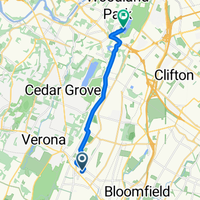
Montclair loop from MHS
A cycling route starting in Montclair, New Jersey, United States.
Overview
About this route
- 40 min
- Duration
- 11.9 km
- Distance
- 172 m
- Ascent
- 169 m
- Descent
- 17.6 km/h
- Avg. speed
- ---
- Max. altitude
Route quality
Waytypes & surfaces along the route
Waytypes
Quiet road
5.9 km
(50 %)
Road
5.5 km
(46 %)
Surfaces
Paved
1.6 km
(14 %)
Asphalt
1.6 km
(14 %)
Undefined
10.2 km
(86 %)
Continue with Bikemap
Use, edit, or download this cycling route
You would like to ride Montclair loop from MHS or customize it for your own trip? Here is what you can do with this Bikemap route:
Free features
- Save this route as favorite or in collections
- Copy & plan your own version of this route
- Sync your route with Garmin or Wahoo
Premium features
Free trial for 3 days, or one-time payment. More about Bikemap Premium.
- Navigate this route on iOS & Android
- Export a GPX / KML file of this route
- Create your custom printout (try it for free)
- Download this route for offline navigation
Discover more Premium features.
Get Bikemap PremiumFrom our community
Other popular routes starting in Montclair
- Claridge Drive 1, Verona to Morris Avenue 86, Summit
- Distance
- 20.5 km
- Ascent
- 402 m
- Descent
- 495 m
- Location
- Montclair, New Jersey, United States
- Montclair loop from MHS
- Distance
- 11.9 km
- Ascent
- 172 m
- Descent
- 169 m
- Location
- Montclair, New Jersey, United States
- Home to Work
- Distance
- 10.9 km
- Ascent
- 47 m
- Descent
- 103 m
- Location
- Montclair, New Jersey, United States
- Chestnut St, Montclair to 200 Forest St, Montclair
- Distance
- 29.7 km
- Ascent
- 196 m
- Descent
- 187 m
- Location
- Montclair, New Jersey, United States
- 248 CR-623, Montclair to 499 Bloomfield Ave, Newark
- Distance
- 34.2 km
- Ascent
- 174 m
- Descent
- 220 m
- Location
- Montclair, New Jersey, United States
- 73 Valley Rd, Montclair to 75 Valley Rd, Montclair
- Distance
- 17.3 km
- Ascent
- 103 m
- Descent
- 106 m
- Location
- Montclair, New Jersey, United States
- 285 CR-623, Montclair to 869 Main St, Paterson
- Distance
- 10.2 km
- Ascent
- 50 m
- Descent
- 86 m
- Location
- Montclair, New Jersey, United States
- Watchung Reservation Route
- Distance
- 89.5 km
- Ascent
- 869 m
- Descent
- 871 m
- Location
- Montclair, New Jersey, United States
Open it in the app