

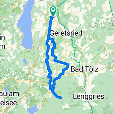
Bürgermeister-Schwaiger-Straße 3, Wolfratshausen nach Marktstraße 15, Lenggries
A cycling route starting in Wolfratshausen, Bavaria, Germany.
Overview
About this route
- 5 h 40 min
- Duration
- 82.4 km
- Distance
- 1,544 m
- Ascent
- 1,375 m
- Descent
- 14.6 km/h
- Avg. speed
- ---
- Max. altitude

Route photos


Route quality
Waytypes & surfaces along the route
Waytypes
Track
22.2 km
(27 %)
Cycleway
14.8 km
(18 %)
Surfaces
Paved
62.6 km
(76 %)
Unpaved
17.3 km
(21 %)
Asphalt
61.8 km
(75 %)
Gravel
10.7 km
(13 %)
Continue with Bikemap
Use, edit, or download this cycling route
You would like to ride Bürgermeister-Schwaiger-Straße 3, Wolfratshausen nach Marktstraße 15, Lenggries or customize it for your own trip? Here is what you can do with this Bikemap route:
Free features
- Save this route as favorite or in collections
- Copy & plan your own version of this route
- Split it into stages to create a multi-day tour
- Sync your route with Garmin or Wahoo
Premium features
Free trial for 3 days, or one-time payment. More about Bikemap Premium.
- Navigate this route on iOS & Android
- Export a GPX / KML file of this route
- Create your custom printout (try it for free)
- Download this route for offline navigation
Discover more Premium features.
Get Bikemap PremiumFrom our community
Other popular routes starting in Wolfratshausen
 Wolfratshausen-Fischbach
- Distance
- 59.4 km
- Ascent
- 614 m
- Descent
- 615 m
- Location
- Wolfratshausen, Bavaria, Germany
 50_Wolfratshausen – München
- Distance
- 36.1 km
- Ascent
- 103 m
- Descent
- 167 m
- Location
- Wolfratshausen, Bavaria, Germany
 Wolfratshausen Kochelsee
- Distance
- 85.6 km
- Ascent
- 716 m
- Descent
- 716 m
- Location
- Wolfratshausen, Bavaria, Germany
 Leichter Trail in WOR
- Distance
- 25.1 km
- Ascent
- 154 m
- Descent
- 179 m
- Location
- Wolfratshausen, Bavaria, Germany
 Wolfratshausen-Neufahrn-Ergertshausen-Wolfratshausen
- Distance
- 13.9 km
- Ascent
- 160 m
- Descent
- 157 m
- Location
- Wolfratshausen, Bavaria, Germany
 geretsried
- Distance
- 44.2 km
- Ascent
- 368 m
- Descent
- 368 m
- Location
- Wolfratshausen, Bavaria, Germany
 Wor-Klosterberg-HoSchäftlarn-Irschen-Mün-Degg-Wor
- Distance
- 46.6 km
- Ascent
- 268 m
- Descent
- 268 m
- Location
- Wolfratshausen, Bavaria, Germany
 TA WOR Lainbachtal
- Distance
- 74.4 km
- Ascent
- 813 m
- Descent
- 809 m
- Location
- Wolfratshausen, Bavaria, Germany
Open it in the app