

B4425, Cheltenham to Bourton Link, Cheltenham
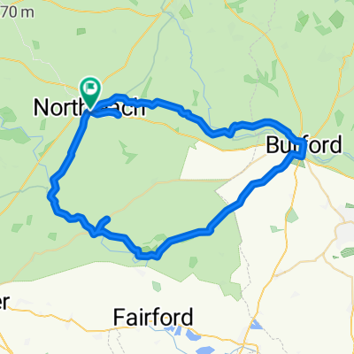
A cycling route starting in Northleach, England, United Kingdom.
Overview
About this route
- 1 h
- Duration
- 14.6 km
- Distance
- 176 m
- Ascent
- 163 m
- Descent
- 14.6 km/h
- Avg. speed
- ---
- Max. altitude
Route quality
Waytypes & surfaces along the route
Waytypes
Quiet road
11.7 km
(80 %)
Road
2.6 km
(18 %)
Surfaces
Paved
0.4 km
(3 %)
Asphalt
0.4 km
(3 %)
Undefined
14.2 km
(97 %)
Continue with Bikemap
Use, edit, or download this cycling route
You would like to ride B4425, Cheltenham to Bourton Link, Cheltenham or customize it for your own trip? Here is what you can do with this Bikemap route:
Free features
- Save this route as favorite or in collections
- Copy & plan your own version of this route
- Sync your route with Garmin or Wahoo
Premium features
Free trial for 3 days, or one-time payment. More about Bikemap Premium.
- Navigate this route on iOS & Android
- Export a GPX / KML file of this route
- Create your custom printout (try it for free)
- Download this route for offline navigation
Discover more Premium features.
Get Bikemap PremiumFrom our community
Other popular routes starting in Northleach
 Northleach2
- Distance
- 30.1 km
- Ascent
- 343 m
- Descent
- 343 m
- Location
- Northleach, England, United Kingdom
 Northleach Winchcombe
- Distance
- 20 km
- Ascent
- 233 m
- Descent
- 303 m
- Location
- Northleach, England, United Kingdom
 4 Hogsdown Farm - Tudor Caravan
- Distance
- 61.8 km
- Ascent
- 176 m
- Descent
- 351 m
- Location
- Northleach, England, United Kingdom
 Northleach1
- Distance
- 34.9 km
- Ascent
- 356 m
- Descent
- 357 m
- Location
- Northleach, England, United Kingdom
 Westwood-Millbeck Day 2
- Distance
- 77.5 km
- Ascent
- 523 m
- Descent
- 468 m
- Location
- Northleach, England, United Kingdom
 Cotswaold Lanes around Burford and Northleach
- Distance
- 51.7 km
- Ascent
- 274 m
- Descent
- 274 m
- Location
- Northleach, England, United Kingdom
 cotswold explorer
- Distance
- 90 km
- Ascent
- 903 m
- Descent
- 902 m
- Location
- Northleach, England, United Kingdom
 Bourton circular via Bibury
- Distance
- 9.6 km
- Ascent
- 143 m
- Descent
- 184 m
- Location
- Northleach, England, United Kingdom
Open it in the app