Tour Mittelschwere Härtsfeldroute
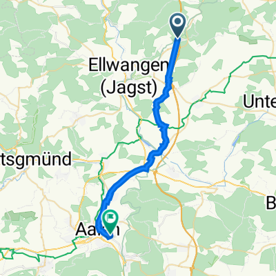
A cycling route starting in Ellenberg, Baden-Wurttemberg, Germany.
Overview
About this route
Route Hirlbach - Zöbingen - Röttingen - Aufhausen - Elchingen - Unterkochen - Hülen - Lauchheim - Hirlbach
- -:--
- Duration
- 80.3 km
- Distance
- 984 m
- Ascent
- 1,033 m
- Descent
- ---
- Avg. speed
- 677 m
- Max. altitude
Route quality
Waytypes & surfaces along the route
Waytypes
Road
37.6 km
(47 %)
Busy road
21.5 km
(27 %)
Surfaces
Paved
61.4 km
(77 %)
Unpaved
0.1 km
(<1 %)
Asphalt
55 km
(69 %)
Paved (undefined)
6.4 km
(8 %)
Continue with Bikemap
Use, edit, or download this cycling route
You would like to ride Tour Mittelschwere Härtsfeldroute or customize it for your own trip? Here is what you can do with this Bikemap route:
Free features
- Save this route as favorite or in collections
- Copy & plan your own version of this route
- Split it into stages to create a multi-day tour
- Sync your route with Garmin or Wahoo
Premium features
Free trial for 3 days, or one-time payment. More about Bikemap Premium.
- Navigate this route on iOS & Android
- Export a GPX / KML file of this route
- Create your custom printout (try it for free)
- Download this route for offline navigation
Discover more Premium features.
Get Bikemap PremiumFrom our community
Other popular routes starting in Ellenberg
- Stocken-Ellwanger Seenland
- Distance
- 23.4 km
- Ascent
- 266 m
- Descent
- 267 m
- Location
- Ellenberg, Baden-Wurttemberg, Germany
- Häsle 6,5km
- Distance
- 6.3 km
- Ascent
- 79 m
- Descent
- 75 m
- Location
- Ellenberg, Baden-Wurttemberg, Germany
- Tour Hirlbach - Heidenheim und zurück
- Distance
- 81.1 km
- Ascent
- 567 m
- Descent
- 550 m
- Location
- Ellenberg, Baden-Wurttemberg, Germany
- Stocken-Ellwanger Seenland
- Distance
- 23.4 km
- Ascent
- 302 m
- Descent
- 302 m
- Location
- Ellenberg, Baden-Wurttemberg, Germany
- Leichte bis mittelschwere Radtour mit Schlußanstieg
- Distance
- 57.7 km
- Ascent
- 484 m
- Descent
- 545 m
- Location
- Ellenberg, Baden-Wurttemberg, Germany
- Einfache Fahrt in Fichtenau
- Distance
- 8.8 km
- Ascent
- 84 m
- Descent
- 85 m
- Location
- Ellenberg, Baden-Wurttemberg, Germany
- Unterd-Matz-Wild-Laut-Unterd
- Distance
- 9.3 km
- Ascent
- 86 m
- Descent
- 85 m
- Location
- Ellenberg, Baden-Wurttemberg, Germany
- Ellwanger Seen Rund
- Distance
- 28.8 km
- Ascent
- 309 m
- Descent
- 309 m
- Location
- Ellenberg, Baden-Wurttemberg, Germany
Open it in the app