

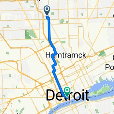
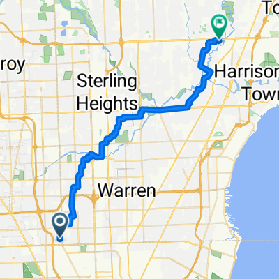
2259 Hamata St, Ferndale to 4474–4498 W Webster Rd, Royal Oak
A cycling route starting in Hazel Park, Michigan, United States.
Overview
About this route
- 2 h 18 min
- Duration
- 14.5 km
- Distance
- 282 m
- Ascent
- 257 m
- Descent
- 6.3 km/h
- Avg. speed
- ---
- Max. altitude

Route quality
Waytypes & surfaces along the route
Waytypes
Quiet road
8.3 km
(57 %)
Pedestrian area
4.1 km
(28 %)
Surfaces
Paved
9.4 km
(65 %)
Concrete
5.7 km
(39 %)
Asphalt
3.8 km
(26 %)
Undefined
5.1 km
(35 %)
Continue with Bikemap
Use, edit, or download this cycling route
You would like to ride 2259 Hamata St, Ferndale to 4474–4498 W Webster Rd, Royal Oak or customize it for your own trip? Here is what you can do with this Bikemap route:
Free features
- Save this route as favorite or in collections
- Copy & plan your own version of this route
- Sync your route with Garmin or Wahoo
Premium features
Free trial for 3 days, or one-time payment. More about Bikemap Premium.
- Navigate this route on iOS & Android
- Export a GPX / KML file of this route
- Create your custom printout (try it for free)
- Download this route for offline navigation
Discover more Premium features.
Get Bikemap PremiumFrom our community
Other popular routes starting in Hazel Park
 1916 E Troy Ave, Ferndale to 1103 W 13 Mile Rd, Madison Heights
- Distance
- 8.2 km
- Ascent
- 4 m
- Descent
- 4 m
- Location
- Hazel Park, Michigan, United States
 Hazel Park to Brooklyn
- Distance
- 38.4 km
- Ascent
- 54 m
- Descent
- 34 m
- Location
- Hazel Park, Michigan, United States
 Work
Work- Distance
- 21.5 km
- Ascent
- 23 m
- Descent
- 29 m
- Location
- Hazel Park, Michigan, United States
 East Elza Avenue to Woodward Avenue
- Distance
- 16.4 km
- Ascent
- 48 m
- Descent
- 10 m
- Location
- Hazel Park, Michigan, United States
 To Westview
- Distance
- 1.8 km
- Ascent
- 0 m
- Descent
- 0 m
- Location
- Hazel Park, Michigan, United States
 East Elza Avenue to CJ's on Hall Road
- Distance
- 37.3 km
- Ascent
- 39 m
- Descent
- 51 m
- Location
- Hazel Park, Michigan, United States
 1537 E Harry Ave, Hazel Park to Canterbury Dr, Southfield
- Distance
- 16.6 km
- Ascent
- 70 m
- Descent
- 42 m
- Location
- Hazel Park, Michigan, United States
 bikeage
- Distance
- 21.7 km
- Ascent
- 27 m
- Descent
- 28 m
- Location
- Hazel Park, Michigan, United States
Open it in the app