

Trans_Bayerwald_Nord_Etappe_3_Waldkirchen_-_Mitterfirmiansreut
A cycling route starting in Waldkirchen, Bavaria, Germany.
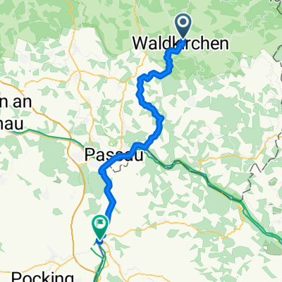
Overview
About this route
These GPS data are the property of the geo-coaching project and are exclusively intended for private use. Commercial use is not permitted without authorization.
- 4 h 55 min
- Duration
- 63.4 km
- Distance
- 2,062 m
- Ascent
- 1,621 m
- Descent
- 12.9 km/h
- Avg. speed
- ---
- Max. altitude
Route quality
Waytypes & surfaces along the route
Waytypes
Track
42.5 km
(67 %)
Quiet road
10.8 km
(17 %)
Surfaces
Paved
8.9 km
(14 %)
Unpaved
43.8 km
(69 %)
Gravel
25.4 km
(40 %)
Asphalt
8.9 km
(14 %)
Continue with Bikemap
Use, edit, or download this cycling route
You would like to ride Trans_Bayerwald_Nord_Etappe_3_Waldkirchen_-_Mitterfirmiansreut or customize it for your own trip? Here is what you can do with this Bikemap route:
Free features
- Save this route as favorite or in collections
- Copy & plan your own version of this route
- Sync your route with Garmin or Wahoo
Premium features
Free trial for 3 days, or one-time payment. More about Bikemap Premium.
- Navigate this route on iOS & Android
- Export a GPX / KML file of this route
- Create your custom printout (try it for free)
- Download this route for offline navigation
Discover more Premium features.
Get Bikemap PremiumFrom our community
Other popular routes starting in Waldkirchen
 Genussradweg von Waldkirchen
- Distance
- 199.3 km
- Ascent
- 1,736 m
- Descent
- 1,740 m
- Location
- Waldkirchen, Bavaria, Germany
 BayerischerWald_Waldkirchen
- Distance
- 97.8 km
- Ascent
- 895 m
- Descent
- 903 m
- Location
- Waldkirchen, Bavaria, Germany
 Waldkirchen-Haidel
- Distance
- 49.7 km
- Ascent
- 748 m
- Descent
- 748 m
- Location
- Waldkirchen, Bavaria, Germany
 Waldkirchen nach Schärding
- Distance
- 51.3 km
- Ascent
- 673 m
- Descent
- 862 m
- Location
- Waldkirchen, Bavaria, Germany
 Trans_Bayerwald_Nord_Etappe_3_Waldkirchen_-_Mitterfirmiansreut
- Distance
- 63.4 km
- Ascent
- 2,062 m
- Descent
- 1,621 m
- Location
- Waldkirchen, Bavaria, Germany
 osterbachtal-Tour Nr.1
- Distance
- 22 km
- Ascent
- 329 m
- Descent
- 331 m
- Location
- Waldkirchen, Bavaria, Germany
 Waldkirchen - Frymburg
- Distance
- 73 km
- Ascent
- 1,436 m
- Descent
- 1,244 m
- Location
- Waldkirchen, Bavaria, Germany
 Haidl-Verlassenes Dorf
- Distance
- 52 km
- Ascent
- 893 m
- Descent
- 890 m
- Location
- Waldkirchen, Bavaria, Germany
Open it in the app