
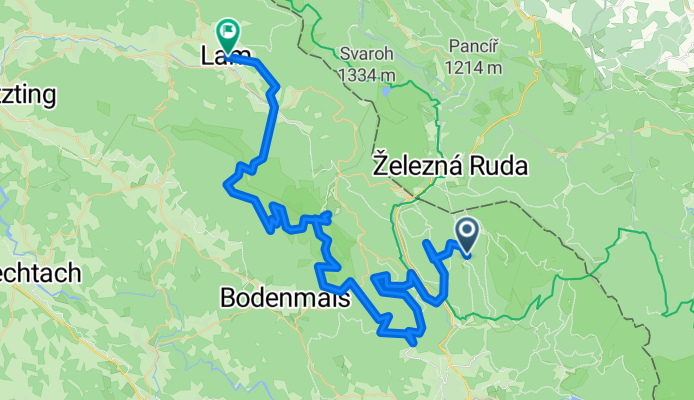
Trans_Bayerwald_Nord_Etappe_6_Zwieslerwaldhaus_-_Lam
A cycling route starting in Bayerisch Eisenstein, Bavaria, Germany.
Overview
About this route
These GPS data are the property of the geo-coaching project and are exclusively intended for private use. Commercial use is not permitted without authorization.
- -:--
- Duration
- 63.2 km
- Distance
- 1,581 m
- Ascent
- 1,729 m
- Descent
- ---
- Avg. speed
- ---
- Max. altitude
Route quality
Waytypes & surfaces along the route
Waytypes
Track
49.3 km
(78 %)
Quiet road
5.7 km
(9 %)
Surfaces
Paved
10.1 km
(16 %)
Unpaved
45.5 km
(72 %)
Gravel
34.1 km
(54 %)
Asphalt
7.6 km
(12 %)
Continue with Bikemap
Use, edit, or download this cycling route
You would like to ride Trans_Bayerwald_Nord_Etappe_6_Zwieslerwaldhaus_-_Lam or customize it for your own trip? Here is what you can do with this Bikemap route:
Free features
- Save this route as favorite or in collections
- Copy & plan your own version of this route
- Sync your route with Garmin or Wahoo
Premium features
Free trial for 3 days, or one-time payment. More about Bikemap Premium.
- Navigate this route on iOS & Android
- Export a GPX / KML file of this route
- Create your custom printout (try it for free)
- Download this route for offline navigation
Discover more Premium features.
Get Bikemap PremiumFrom our community
Other popular routes starting in Bayerisch Eisenstein
 2018_06 Velký Javor pěšky
- Distance
- 17.6 km
- Ascent
- 533 m
- Descent
- 847 m
- Location
- Bayerisch Eisenstein, Bavaria, Germany
 Freitag Abend 2
- Distance
- 8.3 km
- Ascent
- 621 m
- Descent
- 9 m
- Location
- Bayerisch Eisenstein, Bavaria, Germany
 Freitag Abend
- Distance
- 7.8 km
- Ascent
- 605 m
- Descent
- 0 m
- Location
- Bayerisch Eisenstein, Bavaria, Germany
 Bodenmais zum Berghaus Sonnenfels am Arber
- Distance
- 29.5 km
- Ascent
- 1,158 m
- Descent
- 1,179 m
- Location
- Bayerisch Eisenstein, Bavaria, Germany
 Trans_Bayerwald_Nord_Etappe_6_Zwieslerwaldhaus_-_Lam
- Distance
- 63.2 km
- Ascent
- 1,581 m
- Descent
- 1,729 m
- Location
- Bayerisch Eisenstein, Bavaria, Germany
 gr.arber-kl.arber-boenmais
- Distance
- 18 km
- Ascent
- 594 m
- Descent
- 1,015 m
- Location
- Bayerisch Eisenstein, Bavaria, Germany
 20151006_114842.gpx
- Distance
- 6.6 km
- Ascent
- 450 m
- Descent
- 449 m
- Location
- Bayerisch Eisenstein, Bavaria, Germany
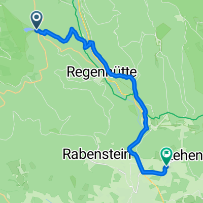 Graf Arbersee, Bayerisch Eisenstein nach Lehener Straße, Lindberg
- Distance
- 15.3 km
- Ascent
- 198 m
- Descent
- 505 m
- Location
- Bayerisch Eisenstein, Bavaria, Germany
Open it in the app