

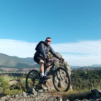
san gerardo-puente pancho
A cycling route starting in Molina, Maule Region, Chile.
Overview
About this route
dirt road from San Gerardo, passing by Bolsico, Los Maitenes, Los Treiles to the Pancho bridge
- -:--
- Duration
- 33.5 km
- Distance
- 444 m
- Ascent
- 226 m
- Descent
- ---
- Avg. speed
- ---
- Max. altitude

Continue with Bikemap
Use, edit, or download this cycling route
You would like to ride san gerardo-puente pancho or customize it for your own trip? Here is what you can do with this Bikemap route:
Free features
- Save this route as favorite or in collections
- Copy & plan your own version of this route
- Sync your route with Garmin or Wahoo
Premium features
Free trial for 3 days, or one-time payment. More about Bikemap Premium.
- Navigate this route on iOS & Android
- Export a GPX / KML file of this route
- Create your custom printout (try it for free)
- Download this route for offline navigation
Discover more Premium features.
Get Bikemap PremiumFrom our community
Other popular routes starting in Molina
 1° Etapa Vuelta Femenina (Grupo A)
- Distance
- 46.3 km
- Ascent
- 169 m
- Descent
- 172 m
- Location
- Molina, Maule Region, Chile
 3 Esquinas Empalme
- Distance
- 24.3 km
- Ascent
- 307 m
- Descent
- 85 m
- Location
- Molina, Maule Region, Chile
 Cumpeo-Monte Oscuro-Cumpeo
- Distance
- 13.2 km
- Ascent
- 88 m
- Descent
- 87 m
- Location
- Molina, Maule Region, Chile
 Domingo 24 de Julio
- Distance
- 96.3 km
- Ascent
- 209 m
- Descent
- 217 m
- Location
- Molina, Maule Region, Chile
 xmc 2
xmc 2- Distance
- 83.9 km
- Ascent
- 538 m
- Descent
- 538 m
- Location
- Molina, Maule Region, Chile
 4° Etapa Vuelta Femenina Grupo A
- Distance
- 52.3 km
- Ascent
- 284 m
- Descent
- 285 m
- Location
- Molina, Maule Region, Chile
 san gerardo-puente pancho
- Distance
- 33.5 km
- Ascent
- 444 m
- Descent
- 226 m
- Location
- Molina, Maule Region, Chile
 yacal
yacal- Distance
- 26.6 km
- Ascent
- 453 m
- Descent
- 264 m
- Location
- Molina, Maule Region, Chile
Open it in the app