

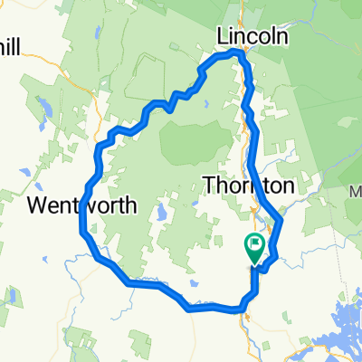
Covered Bridge 40 mile ride
A cycling route starting in Plymouth, New Hampshire, United States.
Overview
About this route
- -:--
- Duration
- 66.1 km
- Distance
- 424 m
- Ascent
- 419 m
- Descent
- ---
- Avg. speed
- ---
- Max. altitude

Route quality
Waytypes & surfaces along the route
Waytypes
Road
26.4 km
(40 %)
Quiet road
9.9 km
(15 %)
Surfaces
Paved
64.1 km
(97 %)
Unpaved
1.3 km
(2 %)
Asphalt
64.1 km
(97 %)
Unpaved (undefined)
1.3 km
(2 %)
Undefined
0.7 km
(1 %)
Continue with Bikemap
Use, edit, or download this cycling route
You would like to ride Covered Bridge 40 mile ride or customize it for your own trip? Here is what you can do with this Bikemap route:
Free features
- Save this route as favorite or in collections
- Copy & plan your own version of this route
- Sync your route with Garmin or Wahoo
Premium features
Free trial for 3 days, or one-time payment. More about Bikemap Premium.
- Navigate this route on iOS & Android
- Export a GPX / KML file of this route
- Create your custom printout (try it for free)
- Download this route for offline navigation
Discover more Premium features.
Get Bikemap PremiumFrom our community
Other popular routes starting in Plymouth
 304 Main St, Plymouth to 273 Main St, Northfield
- Distance
- 44.7 km
- Ascent
- 606 m
- Descent
- 634 m
- Location
- Plymouth, New Hampshire, United States
 Plymouth- Bristol
- Distance
- 88.2 km
- Ascent
- 519 m
- Descent
- 519 m
- Location
- Plymouth, New Hampshire, United States
 Waterville Estates Counterclockwise with Pinnacle Road Bonus
- Distance
- 39.6 km
- Ascent
- 539 m
- Descent
- 536 m
- Location
- Plymouth, New Hampshire, United States
 Plymouth-North Woodstock
- Distance
- 93.3 km
- Ascent
- 748 m
- Descent
- 748 m
- Location
- Plymouth, New Hampshire, United States
 Covered Bridge 40 mile ride
- Distance
- 66.1 km
- Ascent
- 424 m
- Descent
- 419 m
- Location
- Plymouth, New Hampshire, United States
 Waterville Valley
- Distance
- 66.1 km
- Ascent
- 543 m
- Descent
- 543 m
- Location
- Plymouth, New Hampshire, United States
 Plymouth-Woodsville
- Distance
- 142.8 km
- Ascent
- 694 m
- Descent
- 696 m
- Location
- Plymouth, New Hampshire, United States
 Slow ride in Campton
- Distance
- 21.5 km
- Ascent
- 423 m
- Descent
- 423 m
- Location
- Plymouth, New Hampshire, United States
Open it in the app