

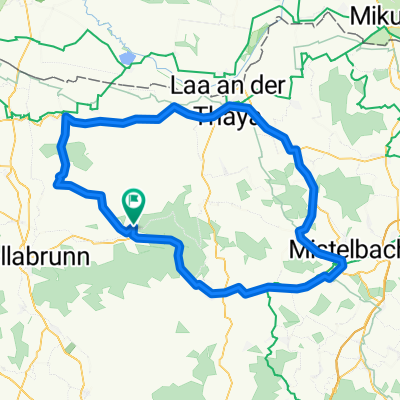
Haugsdorf
A cycling route starting in Stronsdorf, Lower Austria, Austria.
Overview
About this route
- -:--
- Duration
- 58.1 km
- Distance
- 289 m
- Ascent
- 285 m
- Descent
- ---
- Avg. speed
- ---
- Max. altitude

Route quality
Waytypes & surfaces along the route
Waytypes
Track
36 km
(62 %)
Road
9.9 km
(17 %)
Surfaces
Paved
42.4 km
(73 %)
Unpaved
6.4 km
(11 %)
Asphalt
27.3 km
(47 %)
Paved (undefined)
15.1 km
(26 %)
Continue with Bikemap
Use, edit, or download this cycling route
You would like to ride Haugsdorf or customize it for your own trip? Here is what you can do with this Bikemap route:
Free features
- Save this route as favorite or in collections
- Copy & plan your own version of this route
- Sync your route with Garmin or Wahoo
Premium features
Free trial for 3 days, or one-time payment. More about Bikemap Premium.
- Navigate this route on iOS & Android
- Export a GPX / KML file of this route
- Create your custom printout (try it for free)
- Download this route for offline navigation
Discover more Premium features.
Get Bikemap PremiumFrom our community
Other popular routes starting in Stronsdorf
 Klement-Laa-Mailberg
- Distance
- 58.9 km
- Ascent
- 331 m
- Descent
- 331 m
- Location
- Stronsdorf, Lower Austria, Austria
 Steinberg Lauf_kleine Runde
- Distance
- 6.3 km
- Ascent
- 110 m
- Descent
- 107 m
- Location
- Stronsdorf, Lower Austria, Austria
 VerbindungHollabrunn
- Distance
- 26.4 km
- Ascent
- 127 m
- Descent
- 105 m
- Location
- Stronsdorf, Lower Austria, Austria
 Wein4tel - flach nach Laa
- Distance
- 59.5 km
- Ascent
- 293 m
- Descent
- 293 m
- Location
- Stronsdorf, Lower Austria, Austria
 Mistelbach-Laa-Immendorf
- Distance
- 101.1 km
- Ascent
- 373 m
- Descent
- 373 m
- Location
- Stronsdorf, Lower Austria, Austria
 Egenburg-Pulkau Retz
- Distance
- 92.4 km
- Ascent
- 353 m
- Descent
- 354 m
- Location
- Stronsdorf, Lower Austria, Austria
 Sitzendorf a.d. Schmida Runde
- Distance
- 63 km
- Ascent
- 374 m
- Descent
- 374 m
- Location
- Stronsdorf, Lower Austria, Austria
 Steinberg Lauf_große Runde
- Distance
- 10 km
- Ascent
- 256 m
- Descent
- 254 m
- Location
- Stronsdorf, Lower Austria, Austria
Open it in the app