

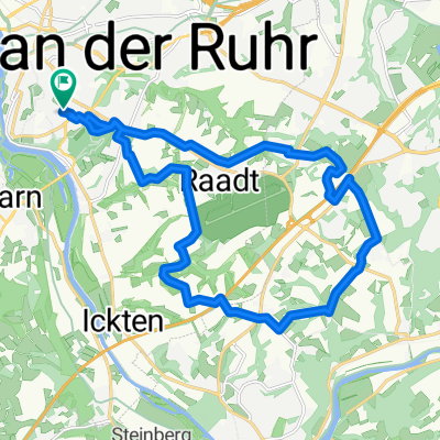
Grugatrasse - RS1 RuhrtalRadweg
A cycling route starting in Mülheim, North Rhine-Westphalia, Germany.
Overview
About this route
- -:--
- Duration
- 50 km
- Distance
- 258 m
- Ascent
- 261 m
- Descent
- ---
- Avg. speed
- ---
- Max. altitude

Route quality
Waytypes & surfaces along the route
Waytypes
Path
21 km
(42 %)
Quiet road
9 km
(18 %)
Surfaces
Paved
40.5 km
(81 %)
Unpaved
7 km
(14 %)
Asphalt
40 km
(80 %)
Gravel
7 km
(14 %)
Route highlights
Points of interest along the route
Accommodation after 16.2 km
Rest. Parlament Ruhrstraße 69, 45219 Essen Tel:02054 1245613 Öffnungszeiten: Samstag 12:00–23:00
Continue with Bikemap
Use, edit, or download this cycling route
You would like to ride Grugatrasse - RS1 RuhrtalRadweg or customize it for your own trip? Here is what you can do with this Bikemap route:
Free features
- Save this route as favorite or in collections
- Copy & plan your own version of this route
- Sync your route with Garmin or Wahoo
Premium features
Free trial for 3 days, or one-time payment. More about Bikemap Premium.
- Navigate this route on iOS & Android
- Export a GPX / KML file of this route
- Create your custom printout (try it for free)
- Download this route for offline navigation
Discover more Premium features.
Get Bikemap PremiumFrom our community
Other popular routes starting in Mülheim
 Zur Ruhrmündung
- Distance
- 32.6 km
- Ascent
- 51 m
- Descent
- 53 m
- Location
- Mülheim, North Rhine-Westphalia, Germany
 Rund um den Flughafen
- Distance
- 19.9 km
- Ascent
- 204 m
- Descent
- 204 m
- Location
- Mülheim, North Rhine-Westphalia, Germany
 Saarn-Selbeck-Breitscheid-Saarn
- Distance
- 19 km
- Ascent
- 91 m
- Descent
- 89 m
- Location
- Mülheim, North Rhine-Westphalia, Germany
 Über stillgelegte Bahnstrecken
- Distance
- 58.1 km
- Ascent
- 91 m
- Descent
- 91 m
- Location
- Mülheim, North Rhine-Westphalia, Germany
 "Berg und Tal" - 2 Stunden Training
- Distance
- 41.1 km
- Ascent
- 522 m
- Descent
- 538 m
- Location
- Mülheim, North Rhine-Westphalia, Germany
 Auf dem Esel
- Distance
- 30.7 km
- Ascent
- 240 m
- Descent
- 261 m
- Location
- Mülheim, North Rhine-Westphalia, Germany
 berg und Tal
- Distance
- 46.5 km
- Ascent
- 949 m
- Descent
- 1,004 m
- Location
- Mülheim, North Rhine-Westphalia, Germany
 Mülheim - Ruhrtal - Essen - Mülheim (510 HM) CLONED FROM ROUTE 36149
- Distance
- 44 km
- Ascent
- 238 m
- Descent
- 238 m
- Location
- Mülheim, North Rhine-Westphalia, Germany
Open it in the app