

CARRERA SIERRALOMA 2010 SEGUNDO DIA
A cycling route starting in Machachi, Pichincha, Ecuador.
Overview
About this route
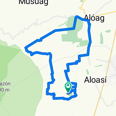
DISTANCE: 29 Km Surface: Cobblestone, Dirt
- -:--
- Duration
- 29 km
- Distance
- 926 m
- Ascent
- 926 m
- Descent
- ---
- Avg. speed
- ---
- Max. altitude
Continue with Bikemap
Use, edit, or download this cycling route
You would like to ride CARRERA SIERRALOMA 2010 SEGUNDO DIA or customize it for your own trip? Here is what you can do with this Bikemap route:
Free features
- Save this route as favorite or in collections
- Copy & plan your own version of this route
- Sync your route with Garmin or Wahoo
Premium features
Free trial for 3 days, or one-time payment. More about Bikemap Premium.
- Navigate this route on iOS & Android
- Export a GPX / KML file of this route
- Create your custom printout (try it for free)
- Download this route for offline navigation
Discover more Premium features.
Get Bikemap PremiumFrom our community
Other popular routes starting in Machachi
 Tour Montaña El Chaupi Día 1
- Distance
- 41.1 km
- Ascent
- 820 m
- Descent
- 820 m
- Location
- Machachi, Pichincha, Ecuador
 CARRERA SIERRALOMA 2010 SEGUNDO DIA
- Distance
- 29 km
- Ascent
- 926 m
- Descent
- 926 m
- Location
- Machachi, Pichincha, Ecuador
 MTB Antenas de la Viudita
- Distance
- 33.1 km
- Ascent
- 1,093 m
- Descent
- 1,094 m
- Location
- Machachi, Pichincha, Ecuador
 Tour Montaña Nestlé Papagayo 80k
- Distance
- 75.5 km
- Ascent
- 1,298 m
- Descent
- 1,298 m
- Location
- Machachi, Pichincha, Ecuador
 Tour Montaña Nestlé Papagayo 40k CLONED FROM ROUTE 1759217
- Distance
- 41.1 km
- Ascent
- 903 m
- Descent
- 903 m
- Location
- Machachi, Pichincha, Ecuador
 Aloasi-3 Marías- Chaupi- Aloasi
- Distance
- 40.2 km
- Ascent
- 639 m
- Descent
- 634 m
- Location
- Machachi, Pichincha, Ecuador
 Movistar Tour Montaña Ilinizas 2016
- Distance
- 72.3 km
- Ascent
- 1,438 m
- Descent
- 1,440 m
- Location
- Machachi, Pichincha, Ecuador
 bike tour through Mejia
- Distance
- 29 km
- Ascent
- 331 m
- Descent
- 573 m
- Location
- Machachi, Pichincha, Ecuador
Open it in the app