

BARRUECO MTB
A cycling route starting in Cáceres, Extremadura, Spain.
Overview
About this route
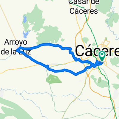
RUTA MALPARTIDA BARRUECO POR ALDEA MORET Y REGRESO POR CAMINO MOTOCROSS Y EL VISO
- -:--
- Duration
- 27 km
- Distance
- 210 m
- Ascent
- 206 m
- Descent
- ---
- Avg. speed
- ---
- Max. altitude

Route highlights
Points of interest along the route
Accommodation after 14.3 km
PARADA REPOSTAJE
Continue with Bikemap
Use, edit, or download this cycling route
You would like to ride BARRUECO MTB or customize it for your own trip? Here is what you can do with this Bikemap route:
Free features
- Save this route as favorite or in collections
- Copy & plan your own version of this route
- Sync your route with Garmin or Wahoo
Premium features
Free trial for 3 days, or one-time payment. More about Bikemap Premium.
- Navigate this route on iOS & Android
- Export a GPX / KML file of this route
- Create your custom printout (try it for free)
- Download this route for offline navigation
Discover more Premium features.
Get Bikemap PremiumFrom our community
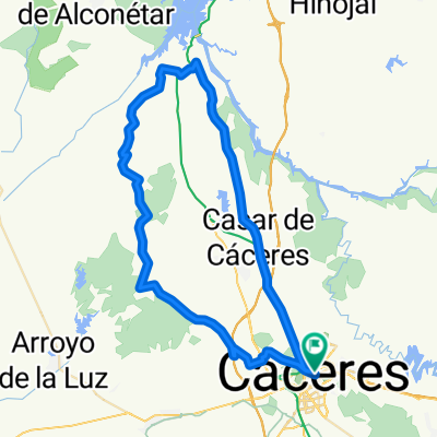
Other popular routes starting in Cáceres
 CASAR- RIBEROS MONROY
- Distance
- 73.6 km
- Ascent
- 543 m
- Descent
- 538 m
- Location
- Cáceres, Extremadura, Spain
 Ruta de las Avutardas
- Distance
- 52.1 km
- Ascent
- 476 m
- Descent
- 476 m
- Location
- Cáceres, Extremadura, Spain
 RUTA 7- CC-ARENALES-ARROYO
- Distance
- 44.9 km
- Ascent
- 169 m
- Descent
- 176 m
- Location
- Cáceres, Extremadura, Spain
 Ruta de las dos vírgenes
- Distance
- 64.1 km
- Ascent
- 341 m
- Descent
- 343 m
- Location
- Cáceres, Extremadura, Spain
 Cáceres - Ermita de San Jorge
- Distance
- 38.3 km
- Ascent
- 360 m
- Descent
- 337 m
- Location
- Cáceres, Extremadura, Spain
 Merendero de la Ex-100
- Distance
- 66 km
- Ascent
- 290 m
- Descent
- 286 m
- Location
- Cáceres, Extremadura, Spain
 Cáceres - Plasencia MTB
- Distance
- 93.6 km
- Ascent
- 677 m
- Descent
- 699 m
- Location
- Cáceres, Extremadura, Spain
 Vuelta Por El Terruco
- Distance
- 32.9 km
- Ascent
- 332 m
- Descent
- 332 m
- Location
- Cáceres, Extremadura, Spain
Open it in the app