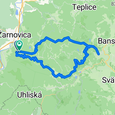
Cesta 512, Horné Hámre až Banícka, Nová Baňa
- 40.8 km
- 189 m
- 233 m
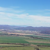
- Žarnovica, Banská Bystrica Region, Slovakia
A cycling route starting in Žarnovica, Banská Bystrica Region, Slovakia.
Overview
created this 5 years ago
Route quality
Road
53 km
(58 %)
Quiet road
12.8 km
(14 %)
Paved
29.2 km
(32 %)
Unpaved
4.6 km
(5 %)
Asphalt
28.3 km
(31 %)
Ground
2.7 km
(3 %)
Continue with Bikemap
You would like to ride zarnovica - sala (bikemap) 2.1 or customize it for your own trip? Here is what you can do with this Bikemap route:
Free trial for 3 days, or one-time payment. More about Bikemap Premium.
Discover more Premium features.
Get Bikemap PremiumFrom our community
Open it in the app