

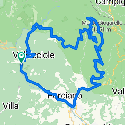
Anello di Camaldoli da Stia
A cycling route starting in Stia, Tuscany, Italy.
Overview
About this route
- -:--
- Duration
- 37.3 km
- Distance
- 1,008 m
- Ascent
- 1,005 m
- Descent
- ---
- Avg. speed
- ---
- Max. altitude

Route quality
Waytypes & surfaces along the route
Waytypes
Quiet road
14.2 km
(38 %)
Road
13.4 km
(36 %)
Surfaces
Paved
14.5 km
(39 %)
Unpaved
5.6 km
(15 %)
Asphalt
14.5 km
(39 %)
Gravel
2.6 km
(7 %)
Continue with Bikemap
Use, edit, or download this cycling route
You would like to ride Anello di Camaldoli da Stia or customize it for your own trip? Here is what you can do with this Bikemap route:
Free features
- Save this route as favorite or in collections
- Copy & plan your own version of this route
- Sync your route with Garmin or Wahoo
Premium features
Free trial for 3 days, or one-time payment. More about Bikemap Premium.
- Navigate this route on iOS & Android
- Export a GPX / KML file of this route
- Create your custom printout (try it for free)
- Download this route for offline navigation
Discover more Premium features.
Get Bikemap PremiumFrom our community
Other popular routes starting in Stia
 TAPPA 20: PRATI ALLA BURRAIA - CAMALDOLI
- Distance
- 13.4 km
- Ascent
- 293 m
- Descent
- 905 m
- Location
- Stia, Tuscany, Italy
 Camaldoli 1
- Distance
- 49.5 km
- Ascent
- 1,327 m
- Descent
- 1,320 m
- Location
- Stia, Tuscany, Italy
 Stia - Santuario S. Maria delle Grazie
- Distance
- 4.3 km
- Ascent
- 335 m
- Descent
- 183 m
- Location
- Stia, Tuscany, Italy
 Pievi e Castelli 2021
- Distance
- 46.2 km
- Ascent
- 743 m
- Descent
- 733 m
- Location
- Stia, Tuscany, Italy
 Molin di Bucchio anello
- Distance
- 38.3 km
- Ascent
- 1,149 m
- Descent
- 1,153 m
- Location
- Stia, Tuscany, Italy
 Anello di Camaldoli da Stia
- Distance
- 37.3 km
- Ascent
- 1,008 m
- Descent
- 1,005 m
- Location
- Stia, Tuscany, Italy
 PFNC 1
- Distance
- 31.8 km
- Ascent
- 1,100 m
- Descent
- 1,057 m
- Location
- Stia, Tuscany, Italy
 Stia - Castello di Romena - Stia
- Distance
- 9 km
- Ascent
- 293 m
- Descent
- 293 m
- Location
- Stia, Tuscany, Italy
Open it in the app