

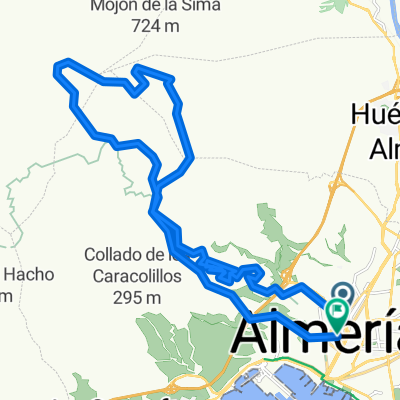
ALMERIA-CALAR ALTO-ALMERIA-2010
A cycling route starting in Almería, Andalusia, Spain.
Overview
About this route
TOUGH ROUTE, WHEREVER THERE ARE ANY, SINCE IT REACHES THE PEAK OF 'LOS FILABRES'. VERY LONG AT 132 KM
- -:--
- Duration
- 132.1 km
- Distance
- 2,124 m
- Ascent
- 2,124 m
- Descent
- ---
- Avg. speed
- ---
- Max. altitude
Route highlights
Points of interest along the route

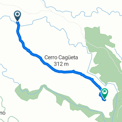
Point of interest after 35.1 km
MONTELLANO. parada tecnica para desayuno y avituallamiento

Point of interest after 49.4 km
CRUCE EL CHORTAL

Point of interest after 65.2 km
PITA DE ICONA, BAJADA HASTA LA MERENDERA

Point of interest after 71 km
LA MERENDERA
Continue with Bikemap
Use, edit, or download this cycling route
You would like to ride ALMERIA-CALAR ALTO-ALMERIA-2010 or customize it for your own trip? Here is what you can do with this Bikemap route:
Free features
- Save this route as favorite or in collections
- Copy & plan your own version of this route
- Split it into stages to create a multi-day tour
- Sync your route with Garmin or Wahoo
Premium features
Free trial for 3 days, or one-time payment. More about Bikemap Premium.
- Navigate this route on iOS & Android
- Export a GPX / KML file of this route
- Create your custom printout (try it for free)
- Download this route for offline navigation
Discover more Premium features.
Get Bikemap PremiumFrom our community
Other popular routes starting in Almería
 Camino de Enix hasta el cortijo
- Distance
- 11 km
- Ascent
- 651 m
- Descent
- 180 m
- Location
- Almería, Andalusia, Spain
 Almería - Santa Fe - Ricaveral
- Distance
- 71.5 km
- Ascent
- 1,012 m
- Descent
- 1,013 m
- Location
- Almería, Andalusia, Spain
 ALMERÍA-ENIX-ALHAMA-ALMERÍA
- Distance
- 64.4 km
- Ascent
- 1,164 m
- Descent
- 1,164 m
- Location
- Almería, Andalusia, Spain
 De Huércal de Almería a Almería
- Distance
- 2.6 km
- Ascent
- 3 m
- Descent
- 341 m
- Location
- Almería, Andalusia, Spain
 ... y se paró!
- Distance
- 31.7 km
- Ascent
- 1,102 m
- Descent
- 1,110 m
- Location
- Almería, Andalusia, Spain
 PESCADERIA , ACANTILADOS
- Distance
- 19.2 km
- Ascent
- 439 m
- Descent
- 439 m
- Location
- Almería, Andalusia, Spain
 Calle Ntra Sra del Río, Almería a Calle de la Virgen de Siracusa, Almería
- Distance
- 1.6 km
- Ascent
- 22 m
- Descent
- 24 m
- Location
- Almería, Andalusia, Spain
 Bombo
Bombo- Distance
- 19.6 km
- Ascent
- 913 m
- Descent
- 4 m
- Location
- Almería, Andalusia, Spain
Open it in the app