

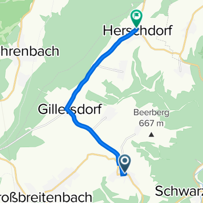
Ortsstraße 52, Wildenspring nach Ochsenbacher Mühle, Neustadt am Rennsteig
A cycling route starting in Böhlen, Free State of Thuringia, Germany.
Overview
About this route
- 55 min
- Duration
- 12.2 km
- Distance
- 353 m
- Ascent
- 257 m
- Descent
- 13.2 km/h
- Avg. speed
- ---
- Max. altitude

Route quality
Waytypes & surfaces along the route
Waytypes
Track
5.5 km
(45 %)
Road
4.8 km
(39 %)
Surfaces
Paved
6.9 km
(56 %)
Unpaved
4.5 km
(37 %)
Asphalt
5.6 km
(46 %)
Gravel
3.4 km
(28 %)
Continue with Bikemap
Use, edit, or download this cycling route
You would like to ride Ortsstraße 52, Wildenspring nach Ochsenbacher Mühle, Neustadt am Rennsteig or customize it for your own trip? Here is what you can do with this Bikemap route:
Free features
- Save this route as favorite or in collections
- Copy & plan your own version of this route
- Sync your route with Garmin or Wahoo
Premium features
Free trial for 3 days, or one-time payment. More about Bikemap Premium.
- Navigate this route on iOS & Android
- Export a GPX / KML file of this route
- Create your custom printout (try it for free)
- Download this route for offline navigation
Discover more Premium features.
Get Bikemap PremiumFrom our community
Other popular routes starting in Böhlen
 Ortsstraße 104, Großbreitenbach nach Lange-Berg-Straße 7, Großbreitenbach
- Distance
- 6.5 km
- Ascent
- 89 m
- Descent
- 61 m
- Location
- Böhlen, Free State of Thuringia, Germany
 Ortsstraße 84, Böhlen nach Hüttenstraße 51, Neustadt am Rennsteig
- Distance
- 11.2 km
- Ascent
- 295 m
- Descent
- 104 m
- Location
- Böhlen, Free State of Thuringia, Germany
 Ortsstraße 140, Großbreitenbach nach Geschwister-Scholl-Straße 2–12, Großbreitenbach
- Distance
- 6.9 km
- Ascent
- 102 m
- Descent
- 65 m
- Location
- Böhlen, Free State of Thuringia, Germany
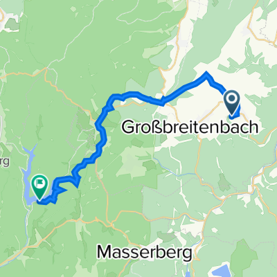 Ortsstraße 140, Großbreitenbach nach Schleusegrund
- Distance
- 18.9 km
- Ascent
- 442 m
- Descent
- 448 m
- Location
- Böhlen, Free State of Thuringia, Germany
 Ortsstraße 52, Wildenspring nach Ochsenbacher Mühle, Neustadt am Rennsteig
- Distance
- 12.2 km
- Ascent
- 353 m
- Descent
- 257 m
- Location
- Böhlen, Free State of Thuringia, Germany
Open it in the app