

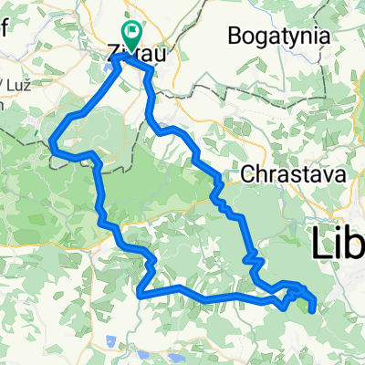
Zittauer_Gebirge_40
A cycling route starting in Zittau, Saxony, Germany.
Overview
About this route
- -:--
- Duration
- 39.1 km
- Distance
- 895 m
- Ascent
- 895 m
- Descent
- ---
- Avg. speed
- ---
- Max. altitude

Continue with Bikemap
Use, edit, or download this cycling route
You would like to ride Zittauer_Gebirge_40 or customize it for your own trip? Here is what you can do with this Bikemap route:
Free features
- Save this route as favorite or in collections
- Copy & plan your own version of this route
- Sync your route with Garmin or Wahoo
Premium features
Free trial for 3 days, or one-time payment. More about Bikemap Premium.
- Navigate this route on iOS & Android
- Export a GPX / KML file of this route
- Create your custom printout (try it for free)
- Download this route for offline navigation
Discover more Premium features.
Get Bikemap PremiumFrom our community
Other popular routes starting in Zittau
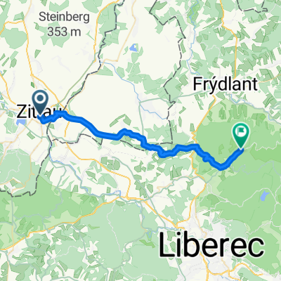
 Von Zittau bis Reichenberg
- Distance
- 34.6 km
- Ascent
- 1,179 m
- Descent
- 456 m
- Location
- Zittau, Saxony, Germany
 rené and anie are going wild #1
- Distance
- 27.9 km
- Ascent
- 611 m
- Descent
- 357 m
- Location
- Zittau, Saxony, Germany
 Zittauer_Gebirge_40
- Distance
- 39.1 km
- Ascent
- 895 m
- Descent
- 895 m
- Location
- Zittau, Saxony, Germany
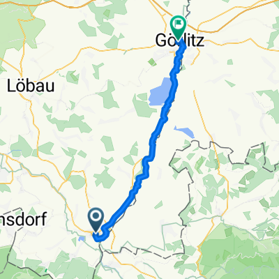 D 01 42km Zittau-Görli
- Distance
- 42 km
- Ascent
- 277 m
- Descent
- 322 m
- Location
- Zittau, Saxony, Germany
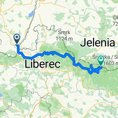
 Zittau - Jeschken - Zittau
- Distance
- 79.7 km
- Ascent
- 1,669 m
- Descent
- 1,668 m
- Location
- Zittau, Saxony, Germany
 Route nach Krummhübel
- Distance
- 120.3 km
- Ascent
- 3,199 m
- Descent
- 2,260 m
- Location
- Zittau, Saxony, Germany
 Zittau - Usedom
- Distance
- 480.6 km
- Ascent
- 152 m
- Descent
- 394 m
- Location
- Zittau, Saxony, Germany
 urlaub 2019 teil 1
- Distance
- 898.1 km
- Ascent
- 240 m
- Descent
- 483 m
- Location
- Zittau, Saxony, Germany
Open it in the app