

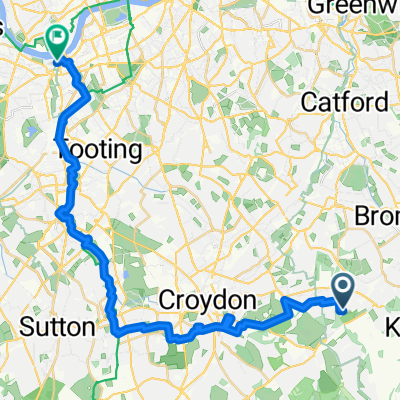
Gates Green Road 97-139 to Cherry Tree Walk 11
A cycling route starting in West Wickham, England, United Kingdom.
Overview
About this route
- 3 h 17 min
- Duration
- 35 km
- Distance
- 297 m
- Ascent
- 344 m
- Descent
- 10.7 km/h
- Avg. speed
- ---
- Max. altitude

Route quality
Waytypes & surfaces along the route
Waytypes
Road
13.6 km
(39 %)
Quiet road
9.8 km
(28 %)
Surfaces
Paved
15.7 km
(45 %)
Unpaved
0.3 km
(1 %)
Asphalt
15.7 km
(45 %)
Gravel
0.3 km
(1 %)
Undefined
18.9 km
(54 %)
Continue with Bikemap
Use, edit, or download this cycling route
You would like to ride Gates Green Road 97-139 to Cherry Tree Walk 11 or customize it for your own trip? Here is what you can do with this Bikemap route:
Free features
- Save this route as favorite or in collections
- Copy & plan your own version of this route
- Sync your route with Garmin or Wahoo
Premium features
Free trial for 3 days, or one-time payment. More about Bikemap Premium.
- Navigate this route on iOS & Android
- Export a GPX / KML file of this route
- Create your custom printout (try it for free)
- Download this route for offline navigation
Discover more Premium features.
Get Bikemap PremiumFrom our community
Other popular routes starting in West Wickham
 Addington to Merle Common
- Distance
- 33.5 km
- Ascent
- 353 m
- Descent
- 366 m
- Location
- West Wickham, England, United Kingdom
 Hayes station 37km
- Distance
- 37.2 km
- Ascent
- 412 m
- Descent
- 415 m
- Location
- West Wickham, England, United Kingdom
 Botley Hill
- Distance
- 30.7 km
- Ascent
- 402 m
- Descent
- 400 m
- Location
- West Wickham, England, United Kingdom
 From West Wickham to London
- Distance
- 31.1 km
- Ascent
- 114 m
- Descent
- 204 m
- Location
- West Wickham, England, United Kingdom
 ahs sponsored walk
- Distance
- 14.4 km
- Ascent
- 205 m
- Descent
- 203 m
- Location
- West Wickham, England, United Kingdom
 New Addington Loop Past Botley Hill and Through Biggin Hill
- Distance
- 24.5 km
- Ascent
- 257 m
- Descent
- 247 m
- Location
- West Wickham, England, United Kingdom
 Hayes to Four Elms
- Distance
- 71.8 km
- Ascent
- 686 m
- Descent
- 688 m
- Location
- West Wickham, England, United Kingdom
 Sutton at Hone route
- Distance
- 50.1 km
- Ascent
- 374 m
- Descent
- 374 m
- Location
- West Wickham, England, United Kingdom
Open it in the app