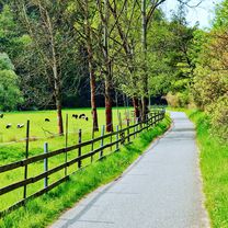
Plešivec 2010
A cycling route starting in Braník, Prague, Czechia.
Overview
About this route
2010/10/28
Zavírák letní a otvírák zimní sezony
- -:--
- Duration
- 125.4 km
- Distance
- 1,108 m
- Ascent
- 1,108 m
- Descent
- ---
- Avg. speed
- ---
- Max. altitude
Route quality
Waytypes & surfaces along the route
Waytypes
Track
58.7 km
(47 %)
Road
20.3 km
(16 %)
Surfaces
Paved
47.6 km
(38 %)
Unpaved
46.4 km
(37 %)
Asphalt
41.4 km
(33 %)
Gravel
17.7 km
(14 %)
Route highlights
Points of interest along the route
Photo after 63 km
Photo after 90.1 km
Photo after 103.9 km
Continue with Bikemap
Use, edit, or download this cycling route
You would like to ride Plešivec 2010 or customize it for your own trip? Here is what you can do with this Bikemap route:
Free features
- Save this route as favorite or in collections
- Copy & plan your own version of this route
- Split it into stages to create a multi-day tour
- Sync your route with Garmin or Wahoo
Premium features
Free trial for 3 days, or one-time payment. More about Bikemap Premium.
- Navigate this route on iOS & Android
- Export a GPX / KML file of this route
- Create your custom printout (try it for free)
- Download this route for offline navigation
Discover more Premium features.
Get Bikemap PremiumFrom our community
Other popular routes starting in Braník
- Z Pankráce na Karlštejn podél vody a přes kopečky zpět
- Distance
- 65.6 km
- Ascent
- 412 m
- Descent
- 412 m
- Location
- Braník, Prague, Czechia
- Troja castle
- Distance
- 13 km
- Ascent
- 108 m
- Descent
- 233 m
- Location
- Braník, Prague, Czechia
- Zbraslav, Černošice, Ořech, Prokopské údolí
- Distance
- 46 km
- Ascent
- 382 m
- Descent
- 382 m
- Location
- Braník, Prague, Czechia
- Kolem Prahy
- Distance
- 104 km
- Ascent
- 635 m
- Descent
- 533 m
- Location
- Braník, Prague, Czechia
- GreenWay Praha-Wien [Praha-Stodulky / Tynec nad Sazavou]
- Distance
- 56.7 km
- Ascent
- 366 m
- Descent
- 396 m
- Location
- Braník, Prague, Czechia
- Greenways Praha - Vídeň I.
- Distance
- 79.5 km
- Ascent
- 963 m
- Descent
- 875 m
- Location
- Braník, Prague, Czechia
- A2: vltavská pravobřežní / Vltava river right-bank cycle route
- Distance
- 15.8 km
- Ascent
- 110 m
- Descent
- 137 m
- Location
- Braník, Prague, Czechia
- BF klasika Barrandak - Halouny
- Distance
- 70.5 km
- Ascent
- 761 m
- Descent
- 760 m
- Location
- Braník, Prague, Czechia
Open it in the app