

Bleiloch-Stausee und Burgk Trails
A cycling route starting in Bad Lobenstein, Thuringia, Germany.
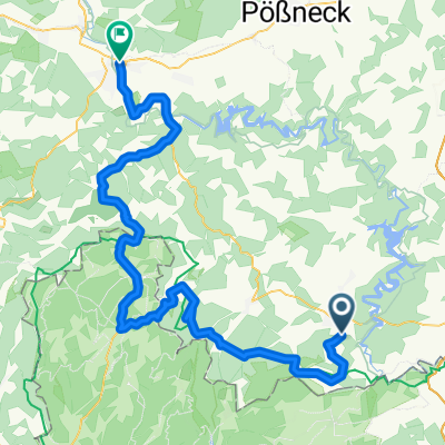
Overview
About this route
After 17 km, one rolls over the dam of the Bleiloch reservoir.
- -:--
- Duration
- 44.6 km
- Distance
- 1,048 m
- Ascent
- 1,047 m
- Descent
- ---
- Avg. speed
- ---
- Max. altitude

Route quality
Waytypes & surfaces along the route
Waytypes
Track
16.5 km
(37 %)
Path
13.8 km
(31 %)
Surfaces
Paved
10.7 km
(24 %)
Unpaved
21.4 km
(48 %)
Asphalt
10.7 km
(24 %)
Ground
9.4 km
(21 %)
Continue with Bikemap
Use, edit, or download this cycling route
You would like to ride Bleiloch-Stausee und Burgk Trails or customize it for your own trip? Here is what you can do with this Bikemap route:
Free features
- Save this route as favorite or in collections
- Copy & plan your own version of this route
- Sync your route with Garmin or Wahoo
Premium features
Free trial for 3 days, or one-time payment. More about Bikemap Premium.
- Navigate this route on iOS & Android
- Export a GPX / KML file of this route
- Create your custom printout (try it for free)
- Download this route for offline navigation
Discover more Premium features.
Get Bikemap PremiumFrom our community
Other popular routes starting in Bad Lobenstein
 Saaldorf 77, Bad Lobenstein nach Saaldorf 77, Bad Lobenstein
- Distance
- 21.6 km
- Ascent
- 532 m
- Descent
- 542 m
- Location
- Bad Lobenstein, Thuringia, Germany
 Helmsgrün - Saalburg
- Distance
- 14.3 km
- Ascent
- 150 m
- Descent
- 323 m
- Location
- Bad Lobenstein, Thuringia, Germany
 Haxen-tour auf dem Rennsteig
- Distance
- 80.1 km
- Ascent
- 591 m
- Descent
- 841 m
- Location
- Bad Lobenstein, Thuringia, Germany
 2-Talsperren-Tour
- Distance
- 62.4 km
- Ascent
- 766 m
- Descent
- 1,051 m
- Location
- Bad Lobenstein, Thuringia, Germany
 Gallenberg
- Distance
- 0.7 km
- Ascent
- 57 m
- Descent
- 0 m
- Location
- Bad Lobenstein, Thuringia, Germany
 Frankenwald
- Distance
- 79.6 km
- Ascent
- 652 m
- Descent
- 907 m
- Location
- Bad Lobenstein, Thuringia, Germany
 Bleiloch-Stausee und Burgk Trails
- Distance
- 44.6 km
- Ascent
- 1,048 m
- Descent
- 1,047 m
- Location
- Bad Lobenstein, Thuringia, Germany
 Göltzschtalbrücke - Gravel
- Distance
- 125.9 km
- Ascent
- 1,151 m
- Descent
- 1,151 m
- Location
- Bad Lobenstein, Thuringia, Germany
Open it in the app