

BM 2011 EZF
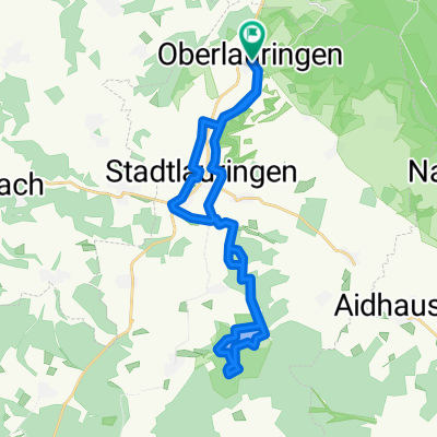
A cycling route starting in Stadtlauringen, Bavaria, Germany.
Overview
About this route
Einzelzeitfahren
- -:--
- Duration
- 12 km
- Distance
- 121 m
- Ascent
- 122 m
- Descent
- ---
- Avg. speed
- ---
- Max. altitude
Route quality
Waytypes & surfaces along the route
Waytypes
Road
6 km
(50 %)
Busy road
3.7 km
(31 %)
Surfaces
Paved
6.9 km
(57 %)
Asphalt
6.7 km
(56 %)
Paved (undefined)
0.1 km
(1 %)
Undefined
5.2 km
(43 %)
Continue with Bikemap
Use, edit, or download this cycling route
You would like to ride BM 2011 EZF or customize it for your own trip? Here is what you can do with this Bikemap route:
Free features
- Save this route as favorite or in collections
- Copy & plan your own version of this route
- Sync your route with Garmin or Wahoo
Premium features
Free trial for 3 days, or one-time payment. More about Bikemap Premium.
- Navigate this route on iOS & Android
- Export a GPX / KML file of this route
- Create your custom printout (try it for free)
- Download this route for offline navigation
Discover more Premium features.
Get Bikemap PremiumFrom our community
Other popular routes starting in Stadtlauringen
 Ellertshäuser See
- Distance
- 37.8 km
- Ascent
- 357 m
- Descent
- 357 m
- Location
- Stadtlauringen, Bavaria, Germany
 Oberlauringen-Ellertshäuser See
- Distance
- 25.2 km
- Ascent
- 200 m
- Descent
- 200 m
- Location
- Stadtlauringen, Bavaria, Germany
 Birnfeld Schweinfurt Haßfurt Hofheim Birnfeld
- Distance
- 76 km
- Ascent
- 321 m
- Descent
- 321 m
- Location
- Stadtlauringen, Bavaria, Germany
 Ellertshäuser See
- Distance
- 4.2 km
- Ascent
- 30 m
- Descent
- 120 m
- Location
- Stadtlauringen, Bavaria, Germany
 Oberlauringen - Maßbach Runde
- Distance
- 22.1 km
- Ascent
- 79 m
- Descent
- 79 m
- Location
- Stadtlauringen, Bavaria, Germany
 Runde Münnerstadt-Stadtlauringen
- Distance
- 68.5 km
- Ascent
- 212 m
- Descent
- 239 m
- Location
- Stadtlauringen, Bavaria, Germany
 birnfeld wetzhausen sulzdorf wettringen nassach birnfeld
- Distance
- 16.3 km
- Ascent
- 138 m
- Descent
- 138 m
- Location
- Stadtlauringen, Bavaria, Germany
 Oberlauringen zum Main und Wern
- Distance
- 80.7 km
- Ascent
- 393 m
- Descent
- 393 m
- Location
- Stadtlauringen, Bavaria, Germany
Open it in the app