

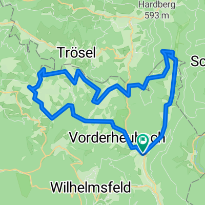
Recovered Route
A cycling route starting in Heiligkreuzsteinach, Baden-Wurttemberg, Germany.
Overview
About this route
- 3 h 37 min
- Duration
- 16.6 km
- Distance
- 429 m
- Ascent
- 427 m
- Descent
- 4.6 km/h
- Avg. speed
- ---
- Max. altitude
Route quality
Waytypes & surfaces along the route
Waytypes
Track
15.1 km
(91 %)
Quiet road
1.2 km
(7 %)
Undefined
0.3 km
(2 %)
Surfaces
Paved
2.5 km
(15 %)
Unpaved
13.5 km
(81 %)
Gravel
10.6 km
(64 %)
Ground
2.8 km
(17 %)
Continue with Bikemap
Use, edit, or download this cycling route
You would like to ride Recovered Route or customize it for your own trip? Here is what you can do with this Bikemap route:
Free features
- Save this route as favorite or in collections
- Copy & plan your own version of this route
- Sync your route with Garmin or Wahoo
Premium features
Free trial for 3 days, or one-time payment. More about Bikemap Premium.
- Navigate this route on iOS & Android
- Export a GPX / KML file of this route
- Create your custom printout (try it for free)
- Download this route for offline navigation
Discover more Premium features.
Get Bikemap PremiumFrom our community
Other popular routes starting in Heiligkreuzsteinach
 AN Feuersteinskopf Prinzensitz Telschikturm AN
- Distance
- 17.4 km
- Ascent
- 398 m
- Descent
- 405 m
- Location
- Heiligkreuzsteinach, Baden-Wurttemberg, Germany
 AN Wolfsgrube Fünfmärkler AN
- Distance
- 13.9 km
- Ascent
- 405 m
- Descent
- 367 m
- Location
- Heiligkreuzsteinach, Baden-Wurttemberg, Germany
 Heilig†steinach - Bad Wimpfen - Dilsberg
- Distance
- 124.5 km
- Ascent
- 863 m
- Descent
- 868 m
- Location
- Heiligkreuzsteinach, Baden-Wurttemberg, Germany
 Eiterbachtal-Tour
- Distance
- 29.7 km
- Ascent
- 890 m
- Descent
- 885 m
- Location
- Heiligkreuzsteinach, Baden-Wurttemberg, Germany
 AN Eiterbach Siedelsbrunn AN
- Distance
- 24.2 km
- Ascent
- 371 m
- Descent
- 364 m
- Location
- Heiligkreuzsteinach, Baden-Wurttemberg, Germany
 AN Eichköpfel Adlerstein Korsika Eichköpfel
- Distance
- 26.1 km
- Ascent
- 627 m
- Descent
- 587 m
- Location
- Heiligkreuzsteinach, Baden-Wurttemberg, Germany
 Heiligkreuzsteinach-Bad Wimpfen-Heiligkreuzsteinach
- Distance
- 106.7 km
- Ascent
- 965 m
- Descent
- 965 m
- Location
- Heiligkreuzsteinach, Baden-Wurttemberg, Germany
 AN Grein Wolfsgrube AN
- Distance
- 16.2 km
- Ascent
- 410 m
- Descent
- 374 m
- Location
- Heiligkreuzsteinach, Baden-Wurttemberg, Germany
Open it in the app