![[V] #054 Babia Góra](/_next/static/media/contour-lines-light-small.cafd5e5d.avif)
![[V] #054 Babia Góra](https://media.bikemap.net/routes/7432964/staticmaps/in_34552177-a112-4354-9da4-48307a0dcf74_694x400_bikemap-2021-3D-static.png)
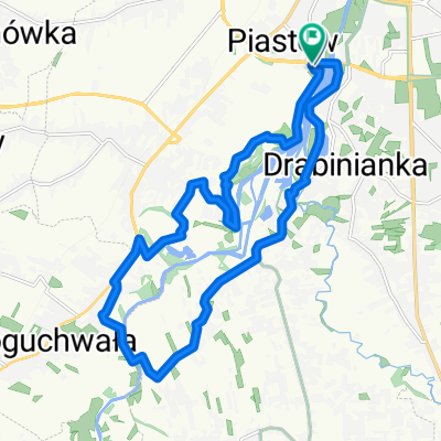
[V] #054 Babia Góra
A cycling route starting in Rzeszów, Subcarpathian Voivodeship, Poland.
Overview
About this route
- -:--
- Duration
- 38.4 km
- Distance
- 220 m
- Ascent
- 219 m
- Descent
- ---
- Avg. speed
- ---
- Max. altitude

Route quality
Waytypes & surfaces along the route
Waytypes
Road
19.2 km
(50 %)
Quiet road
12.7 km
(33 %)
Surfaces
Paved
36.1 km
(94 %)
Asphalt
34.2 km
(89 %)
Paved (undefined)
1.9 km
(5 %)
Undefined
2.3 km
(6 %)
Continue with Bikemap
Use, edit, or download this cycling route
You would like to ride [V] #054 Babia Góra or customize it for your own trip? Here is what you can do with this Bikemap route:
Free features
- Save this route as favorite or in collections
- Copy & plan your own version of this route
- Sync your route with Garmin or Wahoo
Premium features
Free trial for 3 days, or one-time payment. More about Bikemap Premium.
- Navigate this route on iOS & Android
- Export a GPX / KML file of this route
- Create your custom printout (try it for free)
- Download this route for offline navigation
Discover more Premium features.
Get Bikemap PremiumFrom our community
Other popular routes starting in Rzeszów
 Wisząca kładka
- Distance
- 17.6 km
- Ascent
- 114 m
- Descent
- 122 m
- Location
- Rzeszów, Subcarpathian Voivodeship, Poland
 Trasa na niedzielę
- Distance
- 48.8 km
- Ascent
- 155 m
- Descent
- 156 m
- Location
- Rzeszów, Subcarpathian Voivodeship, Poland
 Rzeszów, Terliczka, Czarna, Łańcut, Kraczkowa, Malawa, Rzeszów
- Distance
- 43 km
- Ascent
- 119 m
- Descent
- 122 m
- Location
- Rzeszów, Subcarpathian Voivodeship, Poland
 Objazd Wisłoka nocom, gdzie żabole rechocom
- Distance
- 15.7 km
- Ascent
- 44 m
- Descent
- 41 m
- Location
- Rzeszów, Subcarpathian Voivodeship, Poland
 Zalew Czyste, Grodzisko dolne
- Distance
- 90.2 km
- Ascent
- 62 m
- Descent
- 62 m
- Location
- Rzeszów, Subcarpathian Voivodeship, Poland
 Rzeszów - Przylasek - Sołonka - Babica - Krzyż Milenijny - Rzeszów
- Distance
- 64.5 km
- Ascent
- 598 m
- Descent
- 598 m
- Location
- Rzeszów, Subcarpathian Voivodeship, Poland
 Boguchwała
- Distance
- 19.4 km
- Ascent
- 71 m
- Descent
- 71 m
- Location
- Rzeszów, Subcarpathian Voivodeship, Poland
 Rzeszów Skandia Maraton Lang Team 2010 Medio
- Distance
- 50.7 km
- Ascent
- 762 m
- Descent
- 768 m
- Location
- Rzeszów, Subcarpathian Voivodeship, Poland
Open it in the app