

Quillacollo - Tunari
A cycling route starting in Cochabamba, Departamento de Cochabamba, Bolivia.
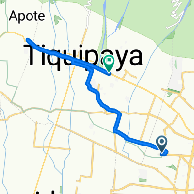
Overview
About this route
- 2 h 36 min
- Duration
- 24.4 km
- Distance
- 1,463 m
- Ascent
- 14 m
- Descent
- 9.4 km/h
- Avg. speed
- ---
- Max. altitude

Route photos


Continue with Bikemap
Use, edit, or download this cycling route
You would like to ride Quillacollo - Tunari or customize it for your own trip? Here is what you can do with this Bikemap route:
Free features
- Save this route as favorite or in collections
- Copy & plan your own version of this route
- Sync your route with Garmin or Wahoo
Premium features
Free trial for 3 days, or one-time payment. More about Bikemap Premium.
- Navigate this route on iOS & Android
- Export a GPX / KML file of this route
- Create your custom printout (try it for free)
- Download this route for offline navigation
Discover more Premium features.
Get Bikemap PremiumFrom our community
Other popular routes starting in Cochabamba
 De Avenida Tadeo Haenke, Cochabamba a Bolivia
- Distance
- 11 km
- Ascent
- 106 m
- Descent
- 0 m
- Location
- Cochabamba, Departamento de Cochabamba, Bolivia
 Salida al Regina (por arriba)
- Distance
- 12 km
- Ascent
- 135 m
- Descent
- 75 m
- Location
- Cochabamba, Departamento de Cochabamba, Bolivia
 Route 2 vuelta tiquipaya
- Distance
- 22.8 km
- Ascent
- 245 m
- Descent
- 245 m
- Location
- Cochabamba, Departamento de Cochabamba, Bolivia
 Pacata - Cristo
- Distance
- 9.4 km
- Ascent
- 476 m
- Descent
- 391 m
- Location
- Cochabamba, Departamento de Cochabamba, Bolivia
 paseo túnel del Abra
- Distance
- 22.5 km
- Ascent
- 315 m
- Descent
- 320 m
- Location
- Cochabamba, Departamento de Cochabamba, Bolivia
 Quillacollo - Calio - Liriuni - Quillacollo - Arocagua
- Distance
- 45.1 km
- Ascent
- 677 m
- Descent
- 574 m
- Location
- Cochabamba, Departamento de Cochabamba, Bolivia
 De Estudiantes, Cochabamba a Calle San Martin 130, Cochabamba
- Distance
- 8.4 km
- Ascent
- 0 m
- Descent
- 0 m
- Location
- Cochabamba, Departamento de Cochabamba, Bolivia
 Universidad
- Distance
- 10.4 km
- Ascent
- 120 m
- Descent
- 22 m
- Location
- Cochabamba, Departamento de Cochabamba, Bolivia
Open it in the app