

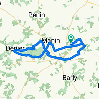
Saulty-Arras
A cycling route starting in Avesnes-le-Comte, Hauts-de-France, France.
Overview
About this route
- 42 min
- Duration
- 19.1 km
- Distance
- 63 m
- Ascent
- 165 m
- Descent
- 27.2 km/h
- Avg. speed
- ---
- Max. altitude

Route quality
Waytypes & surfaces along the route
Waytypes
Path
8.5 km
(44 %)
Road
5.4 km
(28 %)
Surfaces
Paved
13.7 km
(72 %)
Unpaved
0 km
(<1 %)
Asphalt
13.2 km
(69 %)
Paved (undefined)
0.3 km
(2 %)
Continue with Bikemap
Use, edit, or download this cycling route
You would like to ride Saulty-Arras or customize it for your own trip? Here is what you can do with this Bikemap route:
Free features
- Save this route as favorite or in collections
- Copy & plan your own version of this route
- Sync your route with Garmin or Wahoo
Premium features
Free trial for 3 days, or one-time payment. More about Bikemap Premium.
- Navigate this route on iOS & Android
- Export a GPX / KML file of this route
- Create your custom printout (try it for free)
- Download this route for offline navigation
Discover more Premium features.
Get Bikemap PremiumFrom our community
Other popular routes starting in Avesnes-le-Comte
 - Amiens
- Distance
- 51.7 km
- Ascent
- 227 m
- Descent
- 340 m
- Location
- Avesnes-le-Comte, Hauts-de-France, France
 De Rue des Vignes à Rue des Vignes
- Distance
- 30.9 km
- Ascent
- 207 m
- Descent
- 252 m
- Location
- Avesnes-le-Comte, Hauts-de-France, France
 GIVENCHY-JARDIN DE SERICOURT
- Distance
- 34.9 km
- Ascent
- 277 m
- Descent
- 277 m
- Location
- Avesnes-le-Comte, Hauts-de-France, France
 B/F Saulty - Dainville
- Distance
- 13.2 km
- Ascent
- 9 m
- Descent
- 90 m
- Location
- Avesnes-le-Comte, Hauts-de-France, France
 heemskerk
- Distance
- 194.1 km
- Ascent
- 772 m
- Descent
- 777 m
- Location
- Avesnes-le-Comte, Hauts-de-France, France
 groene valleiroute4
- Distance
- 130.7 km
- Ascent
- 320 m
- Descent
- 277 m
- Location
- Avesnes-le-Comte, Hauts-de-France, France
 De Rue d'Ambrines 371, Sars-le-Bois à Grande Rue 140, Avesnes-le-Comte
- Distance
- 9.3 km
- Ascent
- 75 m
- Descent
- 80 m
- Location
- Avesnes-le-Comte, Hauts-de-France, France
 De Rue d'Avesnes, Barly à 5 Rue de l'Abbé Thibault, Berles-au-Bois
- Distance
- 10.7 km
- Ascent
- 110 m
- Descent
- 95 m
- Location
- Avesnes-le-Comte, Hauts-de-France, France
Open it in the app