

埼玉農業用水を走るルート
A cycling route starting in Kōnosu, Saitama, Japan.
Overview
About this route
- 3 h 52 min
- Duration
- 55.4 km
- Distance
- 48 m
- Ascent
- 48 m
- Descent
- 14.3 km/h
- Avg. speed
- ---
- Max. altitude

Route quality
Waytypes & surfaces along the route
Waytypes
Cycleway
24.4 km
(44 %)
Quiet road
17.2 km
(31 %)
Surfaces
Paved
1.1 km
(2 %)
Paved (undefined)
0.6 km
(1 %)
Asphalt
0.6 km
(1 %)
Undefined
54.3 km
(98 %)
Continue with Bikemap
Use, edit, or download this cycling route
You would like to ride 埼玉農業用水を走るルート or customize it for your own trip? Here is what you can do with this Bikemap route:
Free features
- Save this route as favorite or in collections
- Copy & plan your own version of this route
- Sync your route with Garmin or Wahoo
Premium features
Free trial for 3 days, or one-time payment. More about Bikemap Premium.
- Navigate this route on iOS & Android
- Export a GPX / KML file of this route
- Create your custom printout (try it for free)
- Download this route for offline navigation
Discover more Premium features.
Get Bikemap PremiumFrom our community
Other popular routes starting in Kōnosu
 9 川幅日本一体感ルート
- Distance
- 14.4 km
- Ascent
- 64 m
- Descent
- 64 m
- Location
- Kōnosu, Saitama, Japan
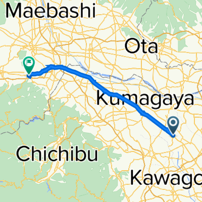 鴻巣市 to 高崎市
- Distance
- 57.2 km
- Ascent
- 80 m
- Descent
- 71 m
- Location
- Kōnosu, Saitama, Japan
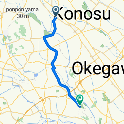 Kōnosu - Okegawa
- Distance
- 14.8 km
- Ascent
- 13 m
- Descent
- 19 m
- Location
- Kōnosu, Saitama, Japan
 Easy ride in 東松山市
- Distance
- 12.5 km
- Ascent
- 42 m
- Descent
- 36 m
- Location
- Kōnosu, Saitama, Japan
 埼玉農業用水を走るルート
- Distance
- 55.4 km
- Ascent
- 48 m
- Descent
- 48 m
- Location
- Kōnosu, Saitama, Japan
 Imaizumi, Yoshimi, Hiki-Gun to Kawataya, Okegawa
- Distance
- 11.5 km
- Ascent
- 94 m
- Descent
- 75 m
- Location
- Kōnosu, Saitama, Japan
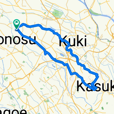
 4 農業用水路を走るルート
- Distance
- 55.8 km
- Ascent
- 143 m
- Descent
- 143 m
- Location
- Kōnosu, Saitama, Japan
 1124−1, 鴻巣市 to 鴻巣市
- Distance
- 32.3 km
- Ascent
- 122 m
- Descent
- 124 m
- Location
- Kōnosu, Saitama, Japan
Open it in the app