

Gleinserhöfe - Maria Waldrast - Ochsenhütte
A cycling route starting in Schönberg im Stubaital, Tyrol, Austria.
Overview
About this route
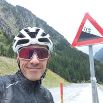
The starting and ending point is the parking lot on Gleinserweg near the Schönberg construction and recycling yard. Follow Gleinserweg uphill on asphalted road up to Gleinserhöfen. From here, continue on a gravel forest path towards Ochsenhütte. However, we first do not ride to the Ochsenhütte but continue southwards up to the 'Gleinser Jöchl' (also known as 'Waldraster Jöch'). If you feel like it, you can go down to 'Maria Waldrast' or back north to the Zangger spring. There, turn left to the Ochsenhütte, where you can enjoy a cozy stop. The return from the Ochsenhütte is in the western direction back to Gleinserhöfen. After about 2 km, take the path towards Mieders and follow the GPX route back to the starting point.
- -:--
- Duration
- 21.6 km
- Distance
- 797 m
- Ascent
- 800 m
- Descent
- ---
- Avg. speed
- ---
- Max. altitude

Route quality
Waytypes & surfaces along the route
Waytypes
Track
17.1 km
(79 %)
Quiet road
4.5 km
(21 %)
Surfaces
Paved
4.3 km
(20 %)
Unpaved
16.9 km
(78 %)
Gravel
12.8 km
(59 %)
Asphalt
4.3 km
(20 %)
Continue with Bikemap
Use, edit, or download this cycling route
You would like to ride Gleinserhöfe - Maria Waldrast - Ochsenhütte or customize it for your own trip? Here is what you can do with this Bikemap route:
Free features
- Save this route as favorite or in collections
- Copy & plan your own version of this route
- Sync your route with Garmin or Wahoo
Premium features
Free trial for 3 days, or one-time payment. More about Bikemap Premium.
- Navigate this route on iOS & Android
- Export a GPX / KML file of this route
- Create your custom printout (try it for free)
- Download this route for offline navigation
Discover more Premium features.
Get Bikemap PremiumFrom our community
Other popular routes starting in Schönberg im Stubaital
 GARDASEE 2014 2
- Distance
- 23.9 km
- Ascent
- 441 m
- Descent
- 23 m
- Location
- Schönberg im Stubaital, Tyrol, Austria
 Römerstraße 1, Schönberg im Stubaital nach Jaufenstraße 1, St. Leonhard in Passeier
- Distance
- 85.2 km
- Ascent
- 2,879 m
- Descent
- 3,208 m
- Location
- Schönberg im Stubaital, Tyrol, Austria
 Handlweg 1, Schönberg im Stubaital nach Matrei am Brenner 97, Pfons
- Distance
- 8.3 km
- Ascent
- 80 m
- Descent
- 102 m
- Location
- Schönberg im Stubaital, Tyrol, Austria
 STUBAITAL (MUTTERBERGALM)
- Distance
- 31 km
- Ascent
- 1,060 m
- Descent
- 277 m
- Location
- Schönberg im Stubaital, Tyrol, Austria
 Brennerstraße-Brenner-Sterzing-St.Leonard im Passeier/Camping
- Distance
- 71 km
- Ascent
- 1,558 m
- Descent
- 1,786 m
- Location
- Schönberg im Stubaital, Tyrol, Austria
 Telfer Wiesen - Stubay
- Distance
- 4.7 km
- Ascent
- 103 m
- Descent
- 142 m
- Location
- Schönberg im Stubaital, Tyrol, Austria
 Radtour Wörthersee - Etappe 3
- Distance
- 154 km
- Ascent
- 1,368 m
- Descent
- 915 m
- Location
- Schönberg im Stubaital, Tyrol, Austria
 Gleinserhöfe - Maria Waldrast - Ochsenhütte
- Distance
- 21.6 km
- Ascent
- 797 m
- Descent
- 800 m
- Location
- Schönberg im Stubaital, Tyrol, Austria
Open it in the app