

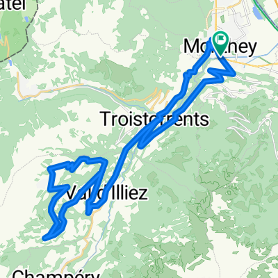
Champoussin par la route de Meureunez
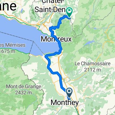
A cycling route starting in Monthey, Valais, Switzerland.
Overview
About this route
From Monthey, climb via Choex-Troistorrents to avoid traffic on the Vallée road. After Val d'Illiez, go straight at the second hairpin (left turn): a small bucolic but paved road that winds through pastures and forest before reaching Champoussin.
- -:--
- Duration
- 36.7 km
- Distance
- 1,201 m
- Ascent
- 1,201 m
- Descent
- ---
- Avg. speed
- ---
- Max. altitude

Route quality
Waytypes & surfaces along the route
Waytypes
Quiet road
16.5 km
(45 %)
Road
7.7 km
(21 %)
Undefined
12.5 km
(34 %)
Surfaces
Paved
12.8 km
(35 %)
Asphalt
12.8 km
(35 %)
Undefined
23.8 km
(65 %)
Continue with Bikemap
Use, edit, or download this cycling route
You would like to ride Champoussin par la route de Meureunez or customize it for your own trip? Here is what you can do with this Bikemap route:
Free features
- Save this route as favorite or in collections
- Copy & plan your own version of this route
- Sync your route with Garmin or Wahoo
Premium features
Free trial for 3 days, or one-time payment. More about Bikemap Premium.
- Navigate this route on iOS & Android
- Export a GPX / KML file of this route
- Create your custom printout (try it for free)
- Download this route for offline navigation
Discover more Premium features.
Get Bikemap PremiumFrom our community
Other popular routes starting in Monthey
 Monthey - Blonay
- Distance
- 44.2 km
- Ascent
- 1,222 m
- Descent
- 334 m
- Location
- Monthey, Valais, Switzerland
 Champoussin par la route de Meureunez
- Distance
- 36.7 km
- Ascent
- 1,201 m
- Descent
- 1,201 m
- Location
- Monthey, Valais, Switzerland
 My Tour
- Distance
- 28.6 km
- Ascent
- 76 m
- Descent
- 93 m
- Location
- Monthey, Valais, Switzerland
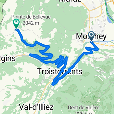
 Gravel de Monthey autour de la pointe Bellevue
- Distance
- 64.2 km
- Ascent
- 1,926 m
- Descent
- 1,925 m
- Location
- Monthey, Valais, Switzerland
 Semaine 2
- Distance
- 40.7 km
- Ascent
- 460 m
- Descent
- 458 m
- Location
- Monthey, Valais, Switzerland
 Col de Portes de Culet– Cols mythiques
- Distance
- 23.3 km
- Ascent
- 1,439 m
- Descent
- 80 m
- Location
- Monthey, Valais, Switzerland
 Boucle Monthey-Bouveret
- Distance
- 45.6 km
- Ascent
- 278 m
- Descent
- 278 m
- Location
- Monthey, Valais, Switzerland
 Chablais d'Enfer Aulp-dessus
- Distance
- 244.4 km
- Ascent
- 5,048 m
- Descent
- 5,048 m
- Location
- Monthey, Valais, Switzerland
Open it in the app