

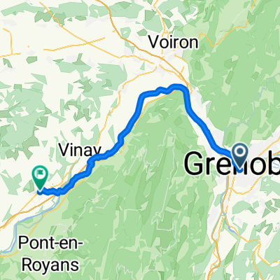
Montée au Charmant Som via Clémencière
A cycling route starting in Saint-Martin-le-Vinoux, Auvergne-Rhône-Alpes, France.
Overview
About this route
6.8 % on average
- -:--
- Duration
- 22.7 km
- Distance
- 1,539 m
- Ascent
- 82 m
- Descent
- ---
- Avg. speed
- ---
- Max. altitude

Route photos


Continue with Bikemap
Use, edit, or download this cycling route
You would like to ride Montée au Charmant Som via Clémencière or customize it for your own trip? Here is what you can do with this Bikemap route:
Free features
- Save this route as favorite or in collections
- Copy & plan your own version of this route
- Sync your route with Garmin or Wahoo
Premium features
Free trial for 3 days, or one-time payment. More about Bikemap Premium.
- Navigate this route on iOS & Android
- Export a GPX / KML file of this route
- Create your custom printout (try it for free)
- Download this route for offline navigation
Discover more Premium features.
Get Bikemap PremiumFrom our community
Other popular routes starting in Saint-Martin-le-Vinoux
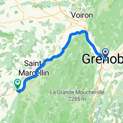
 A 02-04-GENOBLE/SAINT MARCELLIN 52KM
- Distance
- 51.3 km
- Ascent
- 251 m
- Descent
- 185 m
- Location
- Saint-Martin-le-Vinoux, Auvergne-Rhône-Alpes, France
 col de la placette
- Distance
- 58.7 km
- Ascent
- 523 m
- Descent
- 522 m
- Location
- Saint-Martin-le-Vinoux, Auvergne-Rhône-Alpes, France
 Saint-Martin-le-Vinoux - Saint-Lattier
- Distance
- 64.6 km
- Ascent
- 490 m
- Descent
- 521 m
- Location
- Saint-Martin-le-Vinoux, Auvergne-Rhône-Alpes, France
 ancien tram-vouillants
- Distance
- 18.4 km
- Ascent
- 587 m
- Descent
- 585 m
- Location
- Saint-Martin-le-Vinoux, Auvergne-Rhône-Alpes, France
 training path
- Distance
- 33.7 km
- Ascent
- 43 m
- Descent
- 45 m
- Location
- Saint-Martin-le-Vinoux, Auvergne-Rhône-Alpes, France
 Test 1 Bastille
- Distance
- 14.1 km
- Ascent
- 542 m
- Descent
- 542 m
- Location
- Saint-Martin-le-Vinoux, Auvergne-Rhône-Alpes, France
 12 March 23, bike stroll (Saint Laurent)
- Distance
- 6.6 km
- Ascent
- 28 m
- Descent
- 23 m
- Location
- Saint-Martin-le-Vinoux, Auvergne-Rhône-Alpes, France
 Tour de France - Etappe 20
- Distance
- 42.8 km
- Ascent
- 424 m
- Descent
- 417 m
- Location
- Saint-Martin-le-Vinoux, Auvergne-Rhône-Alpes, France
Open it in the app