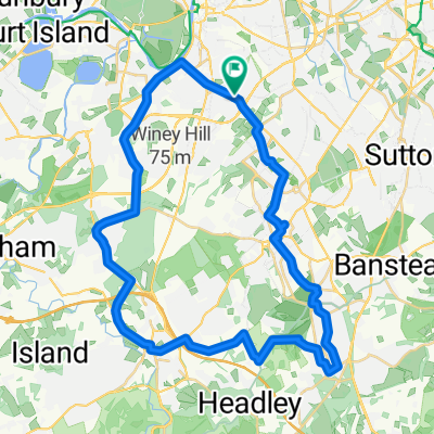
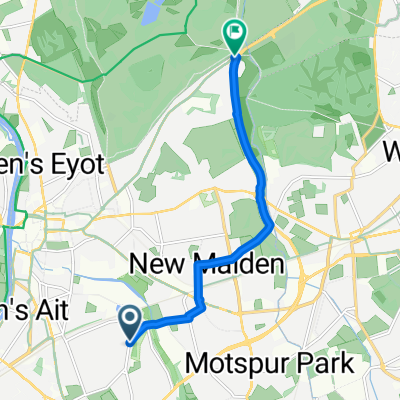
Kingston, to West Surrey, Loop, 21.8m
A cycling route starting in Surbiton, England, United Kingdom.
Overview
About this route
Meander though suburbia and semi-rural Surrey
- -:--
- Duration
- 35.1 km
- Distance
- 193 m
- Ascent
- 189 m
- Descent
- ---
- Avg. speed
- ---
- Avg. speed
Route quality
Waytypes & surfaces along the route
Waytypes
Road
13.6 km
(39 %)
Quiet road
13.2 km
(38 %)
Surfaces
Paved
23.4 km
(67 %)
Unpaved
1.8 km
(5 %)
Asphalt
23 km
(66 %)
Gravel
0.8 km
(2 %)
Continue with Bikemap
Use, edit, or download this cycling route
You would like to ride Kingston, to West Surrey, Loop, 21.8m or customize it for your own trip? Here is what you can do with this Bikemap route:
Free features
- Save this route as favorite or in collections
- Copy & plan your own version of this route
- Sync your route with Garmin or Wahoo
Premium features
Free trial for 3 days, or one-time payment. More about Bikemap Premium.
- Navigate this route on iOS & Android
- Export a GPX / KML file of this route
- Create your custom printout (try it for free)
- Download this route for offline navigation
Discover more Premium features.
Get Bikemap PremiumFrom our community
Other popular routes starting in Surbiton
- London, Big Cafe Ride, 38 miles, 10 Cafes
- Distance
- 59.8 km
- Ascent
- 144 m
- Descent
- 167 m
- Location
- Surbiton, England, United Kingdom
- Surbiton, to Hampton Court, Side Roads, 3.1m
- Distance
- 5 km
- Ascent
- 4 m
- Descent
- 9 m
- Location
- Surbiton, England, United Kingdom
- PodgyOutingOne
- Distance
- 40.6 km
- Ascent
- 26 m
- Descent
- 28 m
- Location
- Surbiton, England, United Kingdom
- London to Brighton
- Distance
- 102.9 km
- Ascent
- 1,260 m
- Descent
- 1,284 m
- Location
- Surbiton, England, United Kingdom
- Surbiton to Woking
- Distance
- 24.2 km
- Ascent
- 88 m
- Descent
- 68 m
- Location
- Surbiton, England, United Kingdom
- suburbia
- Distance
- 36.9 km
- Ascent
- 242 m
- Descent
- 247 m
- Location
- Surbiton, England, United Kingdom
- 'Not' Mike ride to Leigh
- Distance
- 54.6 km
- Ascent
- 396 m
- Descent
- 401 m
- Location
- Surbiton, England, United Kingdom
- Surbiton to Mayfield Farm - BALANCED
- Distance
- 16.2 km
- Ascent
- 150 m
- Descent
- 48 m
- Location
- Surbiton, England, United Kingdom